-

$57.46 CAD
 Land Use & Cover Maui County Hawaii Department Of Planning Development 1976 1978
-
$26.04 CAD
 Geographical Atlas USSR Vintage mini book 1985 Soviet Geographical Encyclopedia
-
$4.99 CAD
 Bartholomew's Revised "Half-Inch" Contoured Maps Great Britain, 58 Cape Wrath
-
$68.50 CAD
 VINTAGE ASBURY PARK, NEW JERSEY STREET MAP 18”x22” Wall Map MONMOUTH COUNTY, NJ
-
$13.70 CAD
 Texas Map - Cameron County - Harlingen La Feria Palm Valley Primera Combes Towns
-
$190.63 CAD
 San Diego County Aerial Graphics Map Book 1984 Photo Atlas Carlsbad Chula Vista
-
$26.32 CAD
 Vintage Metsker's Mason County Map. Mason County Washington.
-
$13.70 CAD
 Texas Highway Map Bastrop County - Elgin Smithville Mcdade - Camp Swift Military
-
$63.02 CAD
 1912 Plat Map ~ OSAKIS - MILTONA BEACH - NELSON Twp., DOUGLAS Co., MINNESOTA
-
$41.14 CAD
 Lower Merion Township, Pennsylvania Map circa 1935 Bryn Mawr
-
$13.71 CAD
 Old Tourist Scheme of Zaporozhye of the Ukrainian SSR USSR 1987 map
-
$63.02 CAD
 1929 Plat Map BROOKFIELD, LA SALLE, Co, IL / GRAND RAPIDS, FARM RIDGE on Reverse
-
$13.70 CAD
 Texas Map Orange County Vidor Bridge City Pinehurst Sabine Lake Neches River TX
-
$226.29 CAD
 NEWFOUNDLAND NOVA SCOTIA GREAT LAKES REGION CANADA 14x18 Print MAP Labrador
-
$16.46 CAD
 Large Vintage Obion County Tennessee Highway Map, RR, Bridges & Much More
-
$15.42 CAD
![1950s Wonderful Britain map, Places to visit, London Kent, 26x20cm [26763]](https://i.ebayimg.com/thumbs/images/g/VV4AAOSwhTRk4NU2/s-l225.jpg) 1950s Wonderful Britain map, Places to visit, London Kent, 26x20cm [26763]
1950s Wonderful Britain map, Places to visit, London Kent, 26x20cm [26763]
-
$63.02 CAD
 1929 Plat Map BROOKFIELD, LA SALLE, Co, ILLINOIS / MILLER - DAYTON on Reverse
-
$10.96 CAD
 Vintage 1987 NICOLLET County, Minnesota Rural Resident Directory Plat Book
-
$61.72 CAD
 Lg Rare 1914 Wall Map Montgomery County Maryland Bethesda Potomac Railroads
-
$13.70 CAD
 Texas Map Lubbock County Slaton Lake Ransom Canyon Buffalo Springs Yellow House
-
$20.56 CAD
 VINTAGE LAND ATLAS & PLAT BOOK 1982 BENTON COUNTY MINNESOTA ROCKFORD MAP
-
$135.77 CAD
 BOOK OF MORMON "A Proposed Map" 1998 Travel Poster 26" X 28" MINT CONDITION
-
$61.72 CAD
 Vintage “A GRAPHIC HISTORY OF DELAWARE COUNTY” Map Lay Out Of 4 Centuries R
-
$27.42 CAD
 Vtg. Soil Survey Of Genesee County Michigan USDA Maps 1972
-
$27.40 CAD
 VTG 1984 Erie Huron Counties Official Street Atlas Commercial Survey Map No. 714
-
$41.13 CAD
 Vintage Soil Survey of Allen County Indiana (1969) USDA - 112+ Foldout Maps
-
$13.70 CAD
 Texas Map - Kleberg County Kingsville City Plan & Airport Texas A & I University
-
$16.44 CAD
 Texas Map Nueces County Corpus Christi Plan Rincon Point Bridge Parks Waterfront
-
$4.99 CAD
 Bartholomew's Revised "Half-Inch" Contoured Maps Great Britain, 40 Ayrshire
-
$356.58 CAD
 Vintage ORIGINAL GERMAN MAP OF WORLD CLIMATE
-
$4.99 CAD
 Bartholomew's Revised "Half-Inch" Contoured Maps Great Britain, 35 Teesdale
-
$4.99 CAD
 Bartholomew's Revised "Half-Inch" Contoured Maps Great Britain, 23 N. Shropshire
-
$17.13 CAD
 QUEENSLAND 1892 Antique Color Map-Bartholomew-Chambers
-
$5.19 CAD
 Vintage France Folding Map Cartoguide Provence Cote D'Azur Shell 1967 #11 French
-
$48.00 CAD
 1958 Fernando And Los Angeles California street map Shell advertising
-
$63.02 CAD
 Old Original 1874 Plat Map ~ ROYALTON - SODUS Twp., BERRIEN Co., MICHIGAN (1x15)
-
$10.96 CAD
 Vintage 1983 TRAVERSE County, Minnesota Rural Resident Directory Plat Book
-
$46.63 CAD
 TENNESSEE Map 1912 ORIGINAL Counties Population Hill's Landseekers Atlas VINTAGE
-
$15.94 CAD
![1950s Wonderful Britain map, Places to visit, Birmingham, 26x20cm [26725]](https://i.ebayimg.com/thumbs/images/g/Qw4AAOSwBmJljDPm/s-l225.jpg) 1950s Wonderful Britain map, Places to visit, Birmingham, 26x20cm [26725]
1950s Wonderful Britain map, Places to visit, Birmingham, 26x20cm [26725]
-
$20.79 CAD
 Large Vintage SEQUATCHIE County Tennessee Highway Map, RR, Bridges & Much More
-
$80.75 CAD
 1912 NORTH DAKOTA Map ORIGINAL Counties Population Bismarck Boundary VINTAGE
-
$63.02 CAD
 1929 Plat Map EAST PEORIA, TAZEWELL Co., IL / WESLEY - CLOVERDALE on Reverse
-
$39.61 CAD
 VERMONT Map 1912 ORIGINAL Counties Population Montpelier Sand Gate Vintage
-
$13.70 CAD
 Texas Map Sabine County Pineland Hemphill Geneva Bronson Rosevine Milam TX
-
$63.02 CAD
 Old Original 1881 Plat Map ~ MAYFLOWER HILL CEM., TAUNTON, MA - BROADWAY
-
$13.70 CAD
 Texas Map - Nacogdoches County Cushing Chireno Sacul Angelina National Forest TX
-
$16.46 CAD
 Map Of Rayburn Country Jasper County Texas American Lakes And Land Houston 1974
-
$63.02 CAD
 1912 Plat Map ~ EAST ALEXANDRIA Twp., DOUGLAS Co., MINNESOTA ~ Free S&H
-
$24.67 CAD
 1955 Tazewell County, Illinois Plat Book
-
$21.76 CAD
 vintage Linn County Iowa paper map arrowcraft incorporated
-
$171.43 CAD
 VINTAGE 1970's Marion County Florida Real Estate Atlas MAPS/PLATS
-
$20.57 CAD
 Vintage 1941 Large Lorain County Oh. And Vicinity Map Directory AUTOMOBILE CLUB
-
$17.82 CAD
 USSR School POSTER WALL MAP Feudal RUS' 12th Century 1.4 m=56" Vintage Soviet
-
$40.17 CAD
 1974 large NAUTICAL MAP england DOVER HARBOUR channel ferries CASTLE terminal
-
$205.03 CAD
 Metsker's Atlas of Stevens County Washington Maps Property Landmarks Roads Folio
-
$63.02 CAD
 1929 Plat Map ~ UTICA, LA SALLE, Co., ILLINOIS / EDEN, VERMILLION on Reverse
-
$16.46 CAD
 Large Vintage Perry County Tennessee Highway Map, RR, Bridges & Much More
-
$16.44 CAD
 Texas Map El Paso County Biggs Field Ascarate Park Mexico Border Rio Grande TX
-
$28.36 CAD
 Vintage 1906 Electric Lines, Railroad & County Map ~ UTAH ~ Old & Authentic
-
$34.29 CAD
 Vintage 1870 City Of Chester,Delaware County Atlas Map,Pennsylvania,Hopkins
-
$10.96 CAD
 Vintage 1983 NOBLES ROCK County, Minnesota Rural Resident Directory Plat Book
-
$27.42 CAD
 Vintage 1960s original historical city map of Greencastle Indiana
-
$18.24 CAD
 Lot of 6 Vintage Italy Travel Maps from 1970's/1980's
-
$63.02 CAD
 Old (15x17) 1929 County / Plat Map ~ TAZEWELL COUNTY, ILLINOIS ~ Free S&H
-
$48.99 CAD
 Old 1915 Plat Book Map ~ WISCONSIN ~ (XLG17x29) ~ Free S&H
-
$63.02 CAD
 Old Original 1881 Plat Map ~ REED & BARTON MFG. CO, TAUNTON, MA - BAY ST.
-
$63.02 CAD
 Old 1915 Plat Map ~ OAKDALE, Twp., MONROE Co., WISCONSIN (LG14x17) Free S&H
-
$63.02 CAD
 1929 Plat Map ~ UTICA Twp., LA SALLE, Co, ILLINOIS / DEER PARK Twp. on Reverse
-
$63.02 CAD
 Old 1915 Plat Map ~ WILTON, Twp., MONROE Co., WISCONSIN (LG14x17) Free S&H
-
$63.02 CAD
 Original 1881 Plat Map WASHINGTON ST., TAUNTON, MA / W. BRITANNIA ST. on Reverse
-
$13.70 CAD
 Texas Map - Jefferson County - Port Arthur Pleasure Island Sabine Lake Groves TX
-
$63.02 CAD
 1929 Plat Map OTTAWA & SOUTH OTTAWA, LA SALLE, Co, ILLINOIS / FALL RIVER Reverse
-
$63.02 CAD
 1915 Plat Map ~ GREENFIELD, TUNNEL CITY, Twp., MONROE Co., WISCONSIN (LG14x17)
-
$63.02 CAD
 Old 1915 Plat Map ~ WELLS, Twp., MONROE Co., WISCONSIN (LG14x17) Free S&H
-
$13.70 CAD
 Texas Map Scurry County Snyder Hermleigh Ira Fluvanna Railroad Lake Thomas TX
-
$63.02 CAD
 Old Original 1881 Plat Map SCHOOL ST., TAUNTON, MA / TREMONT ST. on Reverse
-
$13.70 CAD
 Vintage 1964 NOBLES County, Minnesota Rural Resident Directory Plat Book
-
$63.02 CAD
 1929 Plat Map ~ WALLACE, LA SALLE, Co, ILLINOIS / WALTHAM on Reverse
-
$63.02 CAD
 Old 1929 Plat Map ~ ELM GROVE Twp, Tazewell Co., ILLINOIS / TREMONT on Reverse
-
$13.70 CAD
 Texas Map - Cottle County Paducah Ogden Lazare Swearingen Matador Wildlife Area
-
$54.84 CAD
 Marcus Hook Delaware County Pennsylvania County Map Topographical Upp Chichester
-
$61.70 CAD
 Lot 11 Survey Maps Jefferson County Montana Elk Park Butte Retriever Club Claim
-
$54.84 CAD
 Sheridan Montana Lot of 3 Survey Maps Madison County COS Jefferson River
-
$8.91 CAD
 Foldout Plat Map Cheyenne County Nebraska 1983
-
$63.02 CAD
 Old 1915 Plat Map ~ SOUTH PART of SPARTA Twp., MONROE Co., WISCONSIN (XLG17x29)
-
$13.70 CAD
 Texas Map Medina County Hondo Castroville Devine Lacoste Quihi D'Hanis Railroads
-
$274.29 CAD
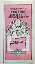 Pittmon Map LINCOLN COUNTY 1991 revision - Newport Toledo Lincoln City
-
$17.14 CAD
 Vtg 1953 Manistee County Michigan Dept Conservation Plat Maps 11" X 17"
-
$63.02 CAD
 1912 Plat Map ~ GRANT Twp., DOUGLAS Co., MINNESOTA - BIG BLUE RIVER ~ Free S&H
-
$17.47 CAD
 Vtg 1955 Ingham County Michigan Dept Conservation Plat Maps 11"X17"
-
$13.70 CAD
 Texas Map - Cochran County - Morton White Face Bledsoe Town Plan - Oil Field
-
$63.02 CAD
 1929 Plat Map ~ MENDOTA, LA SALLE, Co, ILLINOIS / MISSION on Reverse
-
$54.84 CAD
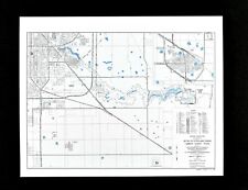
 Fayetteville West Virginia WV County Map 1976 Geological Topographical Survey
-
$137.08 CAD
 C1643 copper engraving ShropShire Area map + mileage Chart Van Langeren
-
$54.84 CAD
 Thurmond West Virginia Fayette County Map New River Gorge Topographical Survey
-
$17.47 CAD
 Vtg 1955 Lake County Michigan Dept Conservation Plat Maps 11"X17"
-
$17.47 CAD
 Vtg 1955 Grand Traverse County Michigan Dept Conservation Plat Maps 11"X17"
-
$13.70 CAD
 Texas Map - Midland County - Bankhead Highway Big Spring Street Airport RR TX
-
$68.56 CAD
 Thomas Bros Guide Metropolitan Washington Dc  1998 atlas- Washington DC Area
-
$50.73 CAD
 Vintage National Geographic Magazine Classical Lands Mediterranean Map 1949


