 Antiques (CA)
-
$193.82 CAD

 RARE 1883 Colonial British New Guinea Map. Areas East of Port Moresby
-
$193.82 CAD
 RARE 1894 Colonial British New Guinea Large Map of Collingwood Bay & Cape Nelson
-
$193.82 CAD
 RARE 1892 Colonial British New Guinea Large Map of The Gulf of Papua. #2
-
$13.56 CAD
 1905 Color Country Maps of New South Wales, Victoria & Tasmania and Australia
-
$140.72 CAD
 RARE 1894 Colonial British New Guinea Map of Tauwara or Milne Bay
-
$136.18 CAD
 Antique Peterman Large Map of Australia Sea Original 1884 Ilyin St. Petersburg
-
$33.01 CAD
 1898. AUSTRALIA. SOUTHERN PART. NEW SOUTH WALES. VICTORIA. Antique BIG SIZE map
-
$13.56 CAD
 1905 Color Country Maps of Queensland Australia and North & South Poles
-
$176.12 CAD
 RARE 1899 Colonial Western Part British New Guinea Huge Folding Map.
-
$140.72 CAD
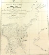
 RARE 1901 Colonial British New Guinea Large Map. Sketch of the Kumusi River.
-
$308.88 CAD
 RARE 1906 Colonial British New Guinea Large Map. The Summit of Mt Albert Edward.
-
$193.82 CAD
 RARE 1896 Colonial British New Guinea Map. Mambare River & Kumusi Valley
-
$193.82 CAD
 RARE 1896 Colonial British New Guinea Large Map. Mambare River to Gosisi Village
-
$264.62 CAD
 RARE 1906 Colonial British New Guinea Large Map. Tamata to Mt Albert Edward.
-
$131.87 CAD
 RARE 1899 Colonial Western Part British New Guinea Huge Folding Map. #2


