 Antiques (CA)
-
$48.14 CAD

 1924 ORIGINAL VINTAGE CITY MAP OF CAMBRIDGE / UNIVERSITY CAMBRIDGESHIRE ENGLAND
-
$33.18 CAD
 1830 Archibald Fullarton Antique Map of The English County of Cambridgeshire
-
$82.96 CAD
 1806 Roper & Cole Antique Map of the County of Cambridgeshire, England
-
$42.23 CAD
 1831 Robert Kearsley Dawson Antique Map of the English County of Cambridgeshire
-
$32.90 CAD
 1831 Lewis Map Carnarvonshire Caernarfonshire Carnarvon Bangor Pwllheli Wales UK
-
$102.86 CAD
 1876 British Isles antique map ~ 27.5" x 19.6" hand colored - Scotland & Ireland
-
$61.72 CAD
 18th century Cambridgeshire England Antique Map by Thomas Kitchin
-
$32.90 CAD
 1831 Lewis Map Cambridgeshire Cambridge Linton Ely Caxton Wisebeah England UK
-
$34.51 CAD
 Vintage 1900 IRELAND Map 11"x14" ~ Old Antique Original DONEGAL DUBLIN GALWAY
-
$432.01 CAD
 1646 Blaeu HUNTINGDONSHIRE antique map ~22.9" x 17.8" large & original
-
$37.14 CAD
 Madingley Hall Cambridgeshire Cambridge Engraving Copperplate Van Der Aa 1707
-
$71.99 CAD
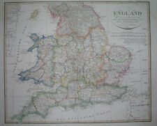 1823 ORIGINAL MAP UNITED KINGDOM ENGLAND WALES LONDON CAMBRIDGE LANCASTER YORK
-
$37.14 CAD
 Wimpole Hall Cambridgeshire Cambridge Engraving Copperplate Van Der Aa 1707
-
$37.43 CAD
 1700 - Hatley South Cambridgeshire England United Kingdom Engraving View
-
$139.11 CAD
 Hatley St.George Cambridgeshire England Garden Kip Map Engraving 1705
-
$38.40 CAD
 1830 Nathan Hale Map England Wales London Liverpool Oxford Cornwall Bristol UK
-
$37.14 CAD
 Hatley St.George Cambridgeshire Cambridge Engraving Van Der Aa 1707
-
$13.70 CAD
 Original 1891 Shire Map HUNTINGDON CAMBRIDGE England Great Eastern Railway March
-
$34.29 CAD
 1876 British Isles map antique ~ 17.3" x 13.8" hand color & US Census maps
-
$38.39 CAD
 1814 John Cary Road Map Cambridgeshire Cambridge Linton Ely Caxton England UK
-
$78.84 CAD
 1823 ORIGINAL MAP IRELAND UNITED KINGDOM ENGLAND WALES SCOTLAND DUBLIN LONDON
-
$102.86 CAD
 1876 Europe antique map ~ 27.5" x 19.5" hand colored - large - ships
-
$6.84 CAD
 Cambridgeshire Bartholomew Half-inch Contoured Paper Fold-Up Map 1963
-
$6.84 CAD
 Cambridgeshire Bartholomew Half-inch Contoured Paper Fold-Up Map 1963


