-

$275.11 CAD
 1843 Map of the Navigable Rivers, Canals & Railroads of Great Britain & Ireland
-
$27.50 CAD
 Antique Laguna Atascosa Texas Map Original USGS Topographic Map 1936 16x20
-
$491.76 CAD
 1628 Henricus Hondius Antique Map Valencia Region of Spain & Mediterranean Sea
-
$275.11 CAD
 1867 Kansas Colorado Montana & Dacota Hand Colored Map 13 x 15 Mitchell Antique
-
$24.76 CAD
 Astronomy Plate 18 - Original Print from Pescheck - 1729
-
$49.52 CAD
 1879 Map Texas & Southern Plains States US Victorian Geography 1st Edition DWAA9
-
$19.95 CAD
 1931 BAEDEKER MAP - Italy GRADO AQUILEIA City Plan + Railroads
-
$49.52 CAD
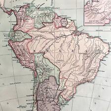 1879 Political Map South America Victorian Harpers Geography 1st Edition DWAA9
-
$49.52 CAD
 1879 Map British Isles England Scotland Victorian Geography 1st Edition DWAA9
-
$88.04 CAD
 c 1650 MERIAN Antique Map Print Fontainebleau Chateau & Gardens France
-
$33.70 CAD
 1888 Antique TINY Texas Map MINIATURE Vintage Texas State Map 1550
-
$33.70 CAD
 1888 TINY Vintage Texas Map MINIATURE Antique Texas State Map 1556
-
$68.76 CAD
 Rare c1940 Nikko Kanaya Hotel National Park Neighborhood Map Honshū Japan Toppan
-
$67.24 CAD
 1843 Asia Map Physical ORIGINAL China Mongolia India Persia Iran Arabia Siberia
-
$522.01 CAD
 Old Authentic 1620 MAP of the WORLD Parchment Paper~ Free S&H Ripped/damaged.
-
$412.66 CAD
 Vintage 24 x 36 1916 Linen Backed Map Oakland San Francisco CA H.A. Candrian
-
$24.72 CAD
 Wind Rain Ocean Routes Map c1894 World Zones Antique Bookplate Illustration B462
-
$39.70 CAD
 1898 Map of the State of OREGON Hand Colored Lithograph 10.75 x 7.25
-
$56.38 CAD
 Antique 1892 Mast, Crowell & Kirtpatrick Popular Atlas Map -Louisiana & Arkansas
-
$109.98 CAD
 SWITZERLAND 1834 Original Map. Excellent condition. Freyburg. Uri. Lucerne...+
-
$619.00 CAD
 BAVARIA GERMANY 1579 ABRAHAM ORTELIUS LARGE ANTIQUE MAP 16TH CENTURY
-
$619.00 CAD
 TIROL- SLOVENIA CROATIA 1579 ABRAHAM ORTELIUS LARGE ANTIQUE MAP 16TH CENTURY
-
$110.04 CAD
 ITALY 1568 SEBASTIAN MUNSTER ANTIQUE ALLEGORIC VIEW 16TH CENTURY
-
$82.53 CAD
 1879 Railroad Map US Industrial Commercial Victorian Geography 1st Edition DWAA9
-
$24.14 CAD
 1902 Antique ARKANSAS State Map Vintage Rand McNally Atlas Map of Arkansas 1499
-
$56.38 CAD
 Antique 1892 Mast, Crowell & Kirtpatrick Popular Atlas Map - The United States!
-
$150.66 CAD
 1891 ANTIQUE MAP ~ GUIANA BRITISH DUTCH & FRENCH ~ OYAMPIS GEORGETOWN
-
$23.33 CAD
 Vintage SOUTH DAKOTA Railroad Map LARGE Old Original 1920s Milwaukee Road
-
$79.78 CAD
 1899 OREGON Map ORIGINAL Portland Eugene Salem Medford Port Orford Coos Bay
-
$89.34 CAD
 Vintage 1892 SAN JOSE CALIFORNIA CA Map 11"x14" Old Antique Original ROSE GARDEN
-
$41.27 CAD
 Antique Colored MAP - PALESTINE - C 1875/Encyclopedia Britannica
-
$27.50 CAD
 USGS Topographic Map Pittsville Maryland Antique Original 1914 16x20
-
$27.50 CAD
 1955 Tourist Map of Castles and Palaces of Czechoslovakia 1:750,000 Poster
-
$56.38 CAD
 Antique 1892 Mast, Crowell & Kirtpatrick Popular Atlas Map- Minnesota, Wisconsin
-
$29.18 CAD
 Vintage WWII War Map Pacific Islands World War II Events Ocean Okinawa Guam
-
$49.52 CAD
 1879 Map New England USA Victorian Atlas Harpers Geography 1st Edition DWAA9
-
$56.38 CAD
 Antique 1892 Mast, Crowell & Kirtpatrick Popular Atlas Map - Ohio and Illinois
-
$49.52 CAD
 1879 Map South Central Atlantic US Victorian Harpers Geography 1st Edition DWAA9
-
$82.46 CAD
 Antique 1912 Book: 'The Library Atlas of the World' Vol. II Foreign Countries
-
$481.43 CAD
 Vintage MCM Mid Century 1950's REPLOGLE 16 INCH LIBRARY GLOBE with Metal Stand
-
$27.51 CAD
 1905 Harmsworth Atlas Map ~ EUROPE - COMMUNICATIONS ~Free S&H #675
-
$48.14 CAD
 1754 Maluku Islands, Indonesia: Carte Particuliere des Isles Moluques - Bellin
-
$40.92 CAD
 1860 ORIGINAL MAP - Europe Asia Showing Extent of Alexander the Great Empire
-
$68.71 CAD
 Temple de Kon Jan Siam Buddhist temple Bellin 1749
-
$226.97 CAD
 Countrycore Mural Vintage Map the Alps Mountains Rollable Wall Chart
-
$56.38 CAD
 Antique 1892 Mast, Crowell & Kirtpatrick Popular Atlas Map - Missouri & Iowa
-
$56.38 CAD
 Antique 1892 Mast, Crowell & Kirtpatrick Popular Atlas Map - Maryland, Delaware
-
$23.37 CAD
 Antique 1885 Map Early Voyages & Discoveries of North America 8x10
-
$27.51 CAD
 1864 Le Bealle Map France - Department Aude Carcassonne Narbonne Limoux Tour de
-
$29.71 CAD
 1921 Antique BROOKLYN City Map Street Map of Brooklyn New York Wall Art 1516
-
$16.51 CAD
 SPAIN Cartagena City Town Plan - 1913 Baedeker Map 4 x 6" (10 x 15 cm)
-
$56.38 CAD
 Antique 1892 Mast, Crowell & Kirtpatrick Popular Atlas Map - Kansas & Nebraska
-
$27.51 CAD
 Antique Map German Offenburg Original Deutschen Reiches
-
$27.51 CAD
 Antique Vintage Map Innsbruck Tyrol Alps Austria
-
$49.52 CAD
 1879 Political Map Of Asia Victorian Atlas Harpers Geography 1st Edition DWAA9
-
$49.52 CAD
 1879 Political Map Europe And Western Asia Victorian Geography 1st Edition DWAA9
-
$49.52 CAD
 1879 Map Asia Desert Arctic Peninsula Belt Victorian Geography 1st Edition DWAA9
-
$49.90 CAD
 1814 John Arrowsmith Antique Map of Europe
-
$18.65 CAD
 Vintage BROOKLYN Map New York City Street Wall Art 1940s Original Decor Antique
-
$67.24 CAD
 1887 Plat Map KANSAS, CLAY CENTER Twp. / VALLEY CENTER - ARGONIA on Reverse #63
-
$22.23 CAD
 1911 Antique Map of Arizona Small Vintage Arizona State Map Wall Decor smap 1537
-
$5.99 CAD
 1981 Russian Travel Brochure with maps of Moscow Region
-
$49.52 CAD
 1879 Map West Central States Group Victorian Atlas Geography 1st Edition DWAA9
-
$20.62 CAD
 c1905 France Area Map///ALONG THE MEDITERRANEAN NICE TO PERPIGNAM, INLAND TO LAC
-
$42.04 CAD
 1898 ORIGINAL ANTIQUE MAP OF CORDOBA / ANDALUSIA / SPAIN
-
$99.03 CAD
 c 1650 Matthaus MERIAN Antique Print -Plan of Reims en Champagne France - Map
-
$34.37 CAD
 1873 RICHLAND CO, OH Color Map / PLYMOUTH TOWNSHIP
-
$111.51 CAD
 1719 Manesson Mallet Antique Map Europe
-
$49.52 CAD
 1879 Map Europe Western And Central Victorian Geography 1st Edition DWAA9
-
$55.01 CAD
 1873 RICHLAND CO, OH Color Map / VILLAGES OF SHELBY, SHILOH, and PLYMOUTH
-
$11.00 CAD
 BRITISH ISLES Map, 1955, 19” x 24”, UK
-
$34.37 CAD
 1873 RICHLAND CO, OH Color Map / JACKSON TOWNSHIP
-
$1300.00 CAD
 Original 1877 ILLUSTRATED HISTORICAL ATLAS OF PEEL by J.H. Pope - Walker & Miles
-
$68.78 CAD
 1856 Black's World Projection with Magnetic Curves - Map 17.3" x 12.5"
-
$82.40 CAD
 Map of Corse Corsica - Original Print Mallet - 1718
-
$29.00 CAD
 NATIONAL GEOGRAPHIC Paris Peace Conference Map of Europe 1920
-
$17.48 CAD
 1800s Antique COLORADO State Map Vintage Map of Colorado Gallery Wall Art Decor
-
$67.24 CAD
 Old 1909 Plat Map ~ AMBOY Twp., COTTONWOOD Co., MINNESOTA ~Free S&H
-
$16.51 CAD
 1897 BAEDEKER MAP - Germany Hamburg & Environs
-
$309.50 CAD
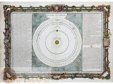 Les Vents Mers ou Terres au strales inconnues, Copernicus System Desnos 1761
-
$34.37 CAD
 1873 RICHLAND CO, OH Color Map / WORTHINGTON TOWNSHIP
-
$27.48 CAD
 Plan Der Stadt Pirmasens - Vintage Map of Pirmasens Germany
-
$343.87 CAD
 1870 Europe Seat of War Franco-Prussian Theatre Map Aetna Ad Railroad Steamship
-
$42.04 CAD
 1898 ORIGINAL ANTIQUE MAP OF OF LISBON / PORTUGAL
-
$23.21 CAD
 Map Smyrna Mills Maine 1955 Topographic Geo Survey 1:62500 Antique 21x17" TOPO1
-
$27.44 CAD
 Ceylon old print Chingulais burn their Dead Bellin 1750
-
$49.52 CAD
 1879 Map Maine United States New England Victorian Geography 1st Edition DWAA9
-
$28.93 CAD
 1897 BAEDEKER MAP - WALES between Bangor & Tremadog
-
$55.01 CAD
 1900 GEAUGA OH Map MIDDLEFIELD, SOUTH PART, TOWNS OF BUNDYSBURG & MONTVILLE
-
$27.51 CAD
 1847 Map ~ SOUTH AMERICA - PANAMA (14x17)-#1757
-
$5.16 CAD
 Rand-McNally state map: FLORIDA USA paper - highway (B63)
-
$31.05 CAD
 1896 ORIGINAL ANTIQUE MAP OF BOSTON / MASSACHUSETTS
-
$42.04 CAD
 1898 ORIGINAL ANTIQUE MAP OF PALACE OF ALHAMBRA GRANADA / ANDALUSIA / SPAIN
-
$27.50 CAD
 1856 Antique Map COURSES OF GALES AND HURRICANES IN NORTH AMERICA & EAST ASIA
-
$23.21 CAD
 Map Seboomook Maine 1954 Topographic Geo Survey 1:62500 Antique 21 x 17" TOPO1
-
$10.00 CAD
 UK MIDLANDS Map, 1955, 19” x 24” central England
-
$24.76 CAD
 1904 ORIGINAL ANTIQUE MAP OF WISMAR / MECKLENBURG / GERMANY
-
$20.62 CAD
 c1905 France Area Map///AREA ACROSS FRANCE SLIGHTLY NORTH OF THE BORDER
-
$54.86 CAD
 1905 Michigan County Map Saginaw Genesee Livingston Clinton Congressional RARE
-
$151.30 CAD
 VINTAGE 1936 LAKE ERIE BEACH, NEW YORK MAP! CANVAS BACKED! ERIE COUNTY,NY 46x16"


