
-
$82.59 CAD

 Atlas del Peru Mapa Politico Departamental 1971
-
$19.08 CAD
 1920 Color Maps Physical Dominion of Canada and Political North America Map
-
$19.08 CAD
 1920 Color Maps Physical/Political Features Russia Finland Sweden Norway Denmark
-
$16.33 CAD
 1920 Color Maps Political Features of France (no explanation of the colors!) Map
-
$82.60 CAD
 Map Peking, China 1913; Forbidden City, Methodist Mission, Churches, Temples
-
$82.60 CAD
 Map Tientsin, China 1913 Foreign Concessions, Imperialism, Drawn Crow's Handbook
-
$27.53 CAD
 1861 Map ~ VENEZUELA - PERU ~ Original Johnson Atlas (14x18) -#1573
-
$27.53 CAD
 1861 Map ~ BRAZIL - ARGENTINA ~ Original Johnson Atlas (14x18) -#1572
-
$27.53 CAD
 1861 Map ~ SWEDEN - NORWAY - DENMARK ~ Original Johnson Atlas (18x26) -#1566
-
$48.17 CAD
 1895 Rand McNally Atlas of the World / CALIFORNIA / 21x29”
-
$137.67 CAD
 China Map 1913 (13 x 16); Treaty Ports, Hong Kong, Shanghai; Drawn for Crow's
-
$27.53 CAD
 1925 Rand McNally Atlas of America NEWYORK /21"x29" Adjoining New Jersey Towns
-
$19.08 CAD
 1920 Color Maps Physical/Political Italy Yugo Slavia and Balkans 2X pages Map
-
$19.08 CAD
 1920 Color Maps Political South America + Mexico Central America West Indies Map
-
$19.08 CAD
 1920 Color Maps Political Australia + Oceania + Victoria New South Wales Map
-
$34.40 CAD
 1930 Clason Touring Atlas of United States & Canada Rear Cover Antique Car
-
$27.53 CAD
 1861 Map ~ ENGLAND - WALES ~ Original Johnson Atlas (18x26) -#1568
-
$27.53 CAD
 1861 Map ~ FRANCE - BELGIUM - HOLLAND ~ Original Johnson Atlas (18x26) -#1567
-
$27.53 CAD
 1861 Map ~ GERMANY #2 & #3 ~ Original Johnson Atlas (18x26) -#1565
-
$27.53 CAD
 1861 Map ~ LOWER & UPPER CANADA ~ Original Johnson Atlas (18x26) -#1570
-
$27.53 CAD
 1861 Map ~ GERMANY #1~ Original Johnson Atlas (14x18) -#1576
-
$27.53 CAD
 1861 Map ~ SCOTLAND ~ Original Johnson Atlas (14x18) -#1578
-
$27.53 CAD
 1861 Map ~ SOUTH AMERICA ~ Original Johnson Atlas (18x26) -#1569
-
$27.53 CAD
 1861 Map ~ RUSSIA in EUROPE ~ Original Johnson Atlas (14x18) -#1574
-
$27.53 CAD
 1861 Map ~ ANIMAL KINGDOM - INDUSTRY ~ Original Johnson Atlas (14x18) -#1580
-
$27.53 CAD
 1861 Map ~ METEROLOGY - RAIN - PLANTS ~ Original Johnson Atlas (14x18) -#1579
-
$48.17 CAD
 1895 Rand McNally Atlas of the World / NEW YORK / 21x29
-
$48.17 CAD
 1895 Rand McNally Atlas of the World / MINNESOTA & MILWAUKEE, WI / 21x29
-
$64.69 CAD
 1840 rare ROUTES ANTIQUE MAP SPAIN PORTUGAL CATALONIA ARAGON VALENCIA BARCELONA
-
$412.95 CAD
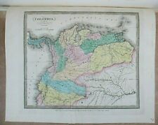 Antique Map of Colombia, Venezuela, Ecuador and Guyana - David H Burr, 1832
-
$273.95 CAD
 Authentic 1873 Atlas Map J DAVID WILLIAMS Atlas of Illinois, Kansas, Missouri
-
$48.17 CAD
 1895 Rand McNally Atlas of the World / NEW JERSEY / 15x21
-
$26.12 CAD
 x3 Antique Framed Maps, Roman Empire, 1648 After Fall Of Westphalia, 1924
-
$48.17 CAD
 1895 Rand McNally Atlas of the World / NEVADA / 15x21
-
$48.17 CAD
 1895 Rand McNally Atlas of the World / SOUTH DAKOTA / 15x21
-
$82.60 CAD
 Map Of Africa J. Arrowsmith, From 1870 Mitchell Atlas, 22“ X 17 1/2“
-
$48.17 CAD
 1895 Rand McNally Atlas of the World / MEXICO / 21x29
-
$48.17 CAD
 1895 Rand McNally Atlas of the World / ARKANSAS / 21x29
-
$48.17 CAD
 1895 Rand McNally Atlas of the World / NORTH DAKOTA / 15x21
-
$48.17 CAD
 1895 Rand McNally Atlas of the World / DETROIT, MI / 21x29”
-
$48.17 CAD
 1895 Rand McNally Atlas of the World / IOWA / 21x29
-
$48.17 CAD
 1895 Rand McNally Atlas of the World / OREGON / 21x29”
-
$9.57 CAD
 1907 CONNECTICUT MAP, Original Engraving, George Cram Atlas~ Counties, Towns, RR


