
-
$225.71 CAD

 Antique MAP-COUNTIES OF IOWA (LYON, OSCEOLA, SIOUX ...) - Andreas Atlas Co. 1875
-
$212.03 CAD
 Antique Colored MAP - GREENWOOD COUNTY - 1887 KANSAS ATLAS
-
$212.03 CAD
 Antique Colored MAP - GREELEY, WICHITA & SCOTT COUNTIES - 1887 KANSAS ATLAS
-
$136.79 CAD
 ANTIQUE Engraving 1875 - ST. MARY'S - ST.JOSEPH COUNTY, INDIANA/Hist. Atlas
-
$68.33 CAD
 1855 Antique Patagonia Argentina Chili Falkland Map Colton's Atlas - great gift!
-
$68.33 CAD
 1855 Antique Canada Newfoundland New Brunswick Map Hand-Colored Colton's Atlas
-
$410.36 CAD
 Atlas of the State of New York; County of Seneca Map #41 - David H Burr, 1829
-
$167.34 CAD
 1695 Robert Morden Antique Map The English County of Rutland (15827)
-
$68.38 CAD
 1867 County Map The State of Illinois Mitchell Brothers Atlas & Plan of Chicago
-
$20.45 CAD
 Maryland & Delaware 1894 Antique MAP ~Unique Atlas ~ Original Color Map
-
$122.06 CAD
 Antique Map - SANGAMON COUNTY Illinois - Warner & Beers/Union Atlas Co. 1876
-
$123.12 CAD
 Antique Map - CRAWFORD COUNTY Illinois - Warner & Beers/Union Atlas Co. 1876
-
$123.12 CAD
Antique Map - SANGAMON COUNTY Illinois - Warner & Beers/Union Atlas Co. 1876
-
$170.99 CAD
 Antique Map - CHAMPAIGN COUNTY Illinois - Warner & Beers/Union Atlas Co. 1876
-
$95.76 CAD
 Antique MAP -LOUDON & WARNER - MERRIMACK COUNTY - N.HAMPSHIRE - 1892 ATLAS
-
$212.03 CAD
 Antique Colored MAP - MITCHELL COUNTY & CAWKER CITY, SIMPSON - 1887 KANSAS ATLAS
-
$250.66 CAD
 Austria Styria map Stiria Mercator/Hondius atlas 1634
-
$68.38 CAD
 1867 County Map of States of Iowa and Missouri Mitchell Brothers Atlas St. Louis
-
$61.56 CAD
 Orig Color Map 1860 Canada East In Counties Montreal Quebec Mitchell's Atlas
-
$68.33 CAD
 1855 Antique Peru & Bolivia Map Hand-Colored Colton's Atlas - Beautiful Gift
-
$136.79 CAD
 1873 Antique Maine Map - Hand-Colored From Colton's Atlas - Beautiful-15” X 17”
-
$191.51 CAD
 Antique Colored MAP - SUMNER COUNTY + CONWAY SPRINGS - 1887 KANSAS ATLAS
-
$82.01 CAD
 1855 Lower East Canada Montreal New Brunswick Map Hand-Colored Colton's Atlas
-
$136.78 CAD
 Elizabeth NJ · RETAIL SHOPPING CENTER Dual Sided MAP & CITY STATS 1920's 37"x27"
-
$247.86 CAD
 Original 1873 Beers MAP BROOKLYN KINGS COUNTY FLATLANDS GRAVESEND NEW UTRECHT
-
$150.46 CAD
 1867 antique map state of New York Mitchell Brothers Atlas hand-colored engraved
-
$124.74 CAD
 Original 1873 Beers MAP BROOKLYN KINGS COUNTY BAY RIDGE - FORT HAMILTON NICE !
-
$129.96 CAD
 1855 Antique Louisiana Map - Hand-Colored From Colton's Atlas - Beautiful Gift!
-
$212.03 CAD
 Antique MAP - MORRIS COUNTY + COUNCIL GROVE - 1887 KANSAS ATLAS
-
$547.18 CAD
 Antique Colored MAP - NEWTON & ENVIRONS - HARVEY COUNTY - 1887 KANSAS ATLAS
-
$129.96 CAD
 Antique Colored MAP - WEBSTER, PLAINVILLE or SMITH COUNTY - 1887 KANSAS ATLAS
-
$239.39 CAD
 Map from Beers Atlas 1874 Addison NY Steuben County NY Professionally Framed
-
$41.04 CAD
 1-1880 ANTIQUE MAP, "WEST PART OF LANCASTER", ERIE COUNTY ATLAS, NY, F W BEERS
-
$68.38 CAD
 Multicolor Gray's New Map of the United States 27x15.5 on 29x17.5 in paper c1890
-
$362.51 CAD
 Holland antique map Hollandia Mercator/Hondius atlas 1607
-
$123.12 CAD
 Antique Map - LEE County Illinois - Warner & Beers/Union Atlas Co. 1876
-
$68.33 CAD
 1855 Antique Brazil & Guyana Map Hand-Colored Colton's Atlas - Beautiful Gift
-
$68.40 CAD
 1901 Colored Map Of Schuylkill County Atlas Of The State Of Pennsylvania 14 x 19
-
$129.96 CAD
 Antique Colored MAP - COLUMBUS or CHEROKEE COUNTY - 1887 KANSAS ATLAS
-
$109.44 CAD
 Antique Colored MAP - HARTLAND or KEARNEY COUNTY - 1887 KANSAS ATLAS
-
$13.67 CAD
 1974 Stevenson County Illinois Plat Book
-
$68.33 CAD
 1855 Antique Venezuela Ecuador Granada Map Hand-Colored Colton's Atlas
-
$253.07 CAD
 Austria Styria map Stiria Mercator/Hondius atlas 1634
-
$107.60 CAD
 .1795 100% GENUINE MAP by WALKER’S GEOGRAPHY. ITALY.
-
$68.40 CAD
 1901 Colored Map Of Warren County Atlas Of The State Of Pennsylvania 14 x 19”
-
$21.87 CAD
 1978 COLES County Illinois Land Atlas Plat Book Illinois Maps Charleston
-
$68.40 CAD
 1901 Colored Map Of McKean County Atlas Of The State Of Pennsylvania 14 x 19”
-
$116.28 CAD
 Map: Delaware, "Nanticoke" 1868 Hand Colored by Pomeroy & Beers
-
$95.76 CAD
 Antique MAP - EXETER - ROCKINGHAM COUNTY - NEW HAMPSHIRE - 1892 ATLAS
-
$109.44 CAD
 Antique Colored MAP - ATWOOD, MILLBROOK or RAWLINS COUNTY - 1887 KANSAS ATLAS
-
$273.58 CAD
 VINTAGE 1975 THE HISTORICAL ATLAS OF FULTON COUNTY INDIANA KINGMAN BRO'S
-
$27.36 CAD
 1-1880 ANTIQUE MAP, "EAST PART OF LANCASTER", ERIE COUNTY ATLAS, NY, F W BEERS
-
$410.36 CAD
 Atlas of the State of New York; County of Chenango Map #33 - David H Burr, 1829
-
$68.33 CAD
 RINGGOLD / TAYLOR COUNTY IOWA MAP from 1875 A.T. Andreas Atlas Original
-
$129.96 CAD
 NICE ANTIQUE MAP - BLACK HAWK/BUTLER COUNTY IOWA - Andreas Atlas Co. 1875
-
$170.98 CAD
 Antique Cooperplate Map of IRELAND 1808 Geography Arrowsmith by Rees & Row
-
$61.56 CAD
 1870 map of Tolland, Mass. from Atlas of Hampden County, with family names
-
$170.99 CAD
 Antique Map of Shrewsbury,N.J. 1889
-
$122.06 CAD
Antique Map - LEE County Illinois - Warner & Beers/Union Atlas Co. 1876
-
$122.06 CAD
 Map -Boone & McHenry Counties Illinois - Warner & Beers/Union Atlas Co. 1876
-
$122.06 CAD
Antique Map - CRAWFORD COUNTY Illinois - Warner & Beers/Union Atlas Co. 1876
-
$150.61 CAD
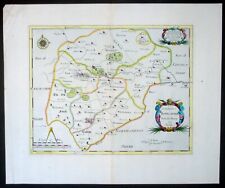
 1695 Robert Morden Antique Map The English County of Rutland, Camden's Britannia
-
$102.60 CAD
 1855 Antique South America Map Hand-Colored Colton's Atlas - Great Gift
-
$170.98 CAD
 Antique Map Chart off the Eastern Coast of AFRICA Zanjibar Ajan Arabia 1743 G. C
-
$109.44 CAD
 Antique Colored MAP - PRATT CENTER or PRATT COUNTY - 1887 KANSAS ATLAS
-
$122.06 CAD
 Antique Map - ROCK ISLAND County Illinois - Warner & Beers/Union Atlas Co. 1876
-
$41.02 CAD
 1877 Atlas Map of Tuscarora & Tyrone Townships, Perry County Pennsylvania
-
$122.06 CAD
 Antique Map - CLAY COUNTY Illinois - Warner & Beers/Union Atlas Co. 1876
-
$122.06 CAD
 Antique Map - GREEN COUNTY Illinois - Warner & Beers/Union Atlas Co. 1876
-
$122.06 CAD
 Antique Map - JEFFERSON COUNTY Illinois - Warner & Beers/Union Atlas Co. 1876
-
$122.06 CAD
 Antique Map - FAYETTE COUNTY Illinois - Warner & Beers/Union Atlas Co. 1876
-
$122.06 CAD
 Antique Map - UNION COUNTY Illinois - Warner & Beers/UNION Atlas Co. 1876
-
$122.06 CAD
 Antique Map - WINNEBAGO County Illinois - Warner & Beers/Union Atlas Co. 1876
-
$256.49 CAD
 ANTIQUE 1869 BROOKLYN TOWN, CANTERBURY VILLAGE, CT HAND COLORED MAP, O. W. GRAY
-
$123.12 CAD
Antique Map - JEFFERSON COUNTY Illinois - Warner & Beers/Union Atlas Co. 1876
-
$123.12 CAD
 Antique Colored MAP - ASHLAND or CLARK COUNTY - 1887 KANSAS ATLAS
-
$94.93 CAD
 ANTIQUE MAP 1875 - SECTIONAL MAP OF ST.JOSEPH COUNTY, INDIANA / HISTORICAL ATLAS
-
$225.71 CAD
 Antique MAP - FRANKLIN FALLS - MERRIMACK COUNTY - N.HAMPSHIRE - 1892 ATLAS
-
$1367.95 CAD
 Original 1915 Atlas of the Ocean Shore Suffolk County Volume 1 E. Belcher Hyde
-
$116.28 CAD
 Map: Delaware, Milford Kent County 1868 by Pomeroy & Beers
-
$129.94 CAD
 Antique Map Chart off the Western Coast of AFRICA Guinea 1743 T. Kitchin
-
$95.76 CAD
ANTIQUE Map 1875 - SECTIONAL MAP OF ST.JOSEPH COUNTY, INDIANA / HISTORICAL ATLAS
-
$109.44 CAD
 Antique Colored MAP - SARATOGA, IUKA or KIOWA COUNTY - 1887 KANSAS ATLAS
-
$170.98 CAD
 Antique Map CONNECTICUT and EASTERN STATES 1838 Geography by Sherman & Smith
-
$62.86 CAD
 Old Vintage 1920 Atlas & Plat Book Map ~ WOODFORD COUNTY, ILLINOIS Free S&H
-
$125.69 CAD
 .1795 100% GENUINE MAP by WALKER’S GEOGRAPHY. POLAND.
-
$223.77 CAD
Antique MAP-COUNTIES OF IOWA (LYON, OSCEOLA, SIOUX - Andreas Atlas Co. 1875
-
$27.35 CAD
 1874 Original Atlas Map of Fountain Green Township, Hancock County Illinois
-
$129.96 CAD
 1860 Louisiana Mississippi Arkansas Map By Augustus Mitchell New General Atlas
-
$123.12 CAD
Antique Map - FAYETTE COUNTY Illinois - Warner & Beers/Union Atlas Co. 1876
-
$75.24 CAD
 Antique MAP - NORTHWOOD - ROCKINGHAM COUNTY - N.HAMPSHIRE - 1892 ATLAS
-
$95.74 CAD
 Richmond Hill, NY map from 1873 atlas
-
$169.53 CAD
Antique Map - CHAMPAIGN COUNTY Illinois - Warner & Beers/Union Atlas Co. 1876
-
$122.06 CAD
 Antique Map - IROQUOIS County Illinois - Warner & Beers/Union Atlas Co. 1876
-
$89.52 CAD
 .1795 100% GENUINE MAP by WALKER’S GEOGRAPHY. ENGLAND and WALES.
-
$169.53 CAD
 Antique Map - PEORIA COUNTY Illinois - Warner & Beers/Union Atlas Co. 1876
-
$129.96 CAD
 Original 1867 Map - North East, New York from Beers County Atlas
-
$410.36 CAD
 Atlas of the State of New York; County of Saratoga Map #19 - David H Burr, 1829
-
$273.59 CAD
 Antique Colored MAP - OSAGE CITY - OSAGE COUNTY, KANSAS - 1887 KANSAS ATLAS
-
$212.03 CAD
 Antique MAP - STANTON, GRANT, HASKEL, MORTON COUNTIES - 1887 KANSAS ATLAS


