 Antiques (CA)
Africa Maps
Asia Maps
Australia/Oceania Maps
Celestial Maps
Central America/Caribbean Maps
Curiosities Maps
Digital Maps
Europe Maps
Map & Globe Mixed Lots
Map & Globe Reproductions
North America Maps
South America Maps
World & Celestial Globes
World Maps

-
$68.57 CAD

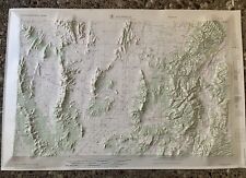
 Cody, Wyoming 1966 US Army Corps Engineers Topographic 3D Molded 21x29 Map
-
$82.27 CAD
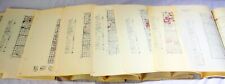
 Massive Lot Of US Geological Maps USGS Topography Vintage Minnesota
-
$240.00 CAD
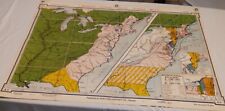
 Vintage 1964 United States US Wall Map Dept of Interior Geological Survey 64x42"
-
$68.55 CAD
 Vintage 1967 Reproduction of 1858 Map of the Plantations along Mississippi River
-
$68.57 CAD
 Vintage 1967 Yosemite Portion of Madera County Cartoon Map
-
$68.56 CAD
 Long Island Map-1961 Courtland Smith Unframed
-
$28.53 CAD
 Lot Of 3 Vintage 1960 Giant Wall Maps Lithographs Mankind, World, Solar System
-
$28.80 CAD
 Vtg 1966 Collet 1770 North Carolina Survey Map W.P. Cumming Map Plate VII
-
$37.03 CAD
 Vintage Grand Teton National Park Geological Survey 27"X21" Map 1968 MOUNT MORAN
-
$54.84 CAD
 1960s U.S. Naval Oceanographic Office 54"x36" Standard Time Zone Chart World Map
-
$16.46 CAD
 VTG World map 1960's printed on blue burlap 38" x 45"
-
$198.86 CAD
 Antique Grapes Lithography print school chart Vintage Cardboard print wall map
-
$24.67 CAD
 Rand Mcnally United Nations Map Of The World And Portfolio 34" x 52" 1961
-
$171.43 CAD
 Brass Old World Map, Masketeers Inc., Mid Century Decor,1960 Wall Hanging
-
$1045.73 CAD
 Grand Teton Map National Park Geological Survey 1968 Best Teton Map Ebay/MINT
-
$82.27 CAD
 Vintage 1964 United States US Map Dept of Interior Geological Survey 64" X 42"
-
$20.57 CAD
 Vtg Eastern Soviet Union USSR Map National Geographic Magazine 1967 Wall Poster
-
$137.15 CAD
 1928 / 1963 Yosemite National Park and Vicinity U.S. Geological Survey Map
-
$20.53 CAD
 Daily Weather Map - US Department of Commerce - January 8, 1961. Aeronautical
-
$68.57 CAD
 VTG 1966 Guadapulita, NM -NEW MEXICO. USGS Topographical Wall Map
-
$109.70 CAD
 Original Large 38" X 40" Birds Eye View Wall Map Of Lincoln NE 1963: Detailed!
-
$20.56 CAD
 PHYSIOGRAPHIC DIAGRAM MAP OF THE SOUTH ATLANTIC OCEAN & THE CARIBBEAN SEA 1961
-
$157.72 CAD
 Vintage 1962 U.S. Geological Survey Map Grand Canyon National Park 38X59 VF.COND
-
$8.91 CAD
 Vintage 1960's Dennison United Statws Wall Map 25"x37" NOS Sealed
-
$68.57 CAD
 VTG 1966 Guadapulita, NM -NEW MEXICO. USGS Topographical Wall Map (B)
-
$75.43 CAD
 Classic USGS Chacon New Mexico 7.5'x7.5' Topo Map 22” X 27”
-
$34.27 CAD
 1963 Washington, Indiana US District Court Plat Wall Map 30"x23.5" - folded
-
$61.65 CAD
 Antique c1905 Draper North Carolina Street and House Lighting Blueprint Map
-
$6.86 CAD
 Vintage 1960 Illinois Geological Survey Map 26.5x21” Wall Map Oil & Gas Fields
-
$68.57 CAD
 55 Vintage 1960s Michigan County Wall Maps DNR 22 Different Counties
-
$97.51 CAD
 Vintage 33.5"x21.5" Germany Deutschland 100% Baumwolle Map Print Fabric Wall Art
-
$96.00 CAD
 Vintage Original 1961 Denmark/Danish Map ‘Smaalandsfarvandet” 42”x30”
-
$30.10 CAD
 Vtg 1966 Post Route 1896 South North Carolina Topographical WP Cumming Map Print
-
$43.89 CAD
 Dinosaur National Monument Geological Survey Map 1965 - USGS - 50" x 30" - VG
-
$94.63 CAD
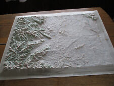
 Vintage 1962 Hubbard Richfield, Utah 3D Topographical Map Prepared by US Army
-
$109.70 CAD
 Topographical Map of USA 1968 United States in 3-D NO FRAME As Is
-
$205.70 CAD
 Map By Catherine & Theodore Nelson “Long Island” 1964 On Wood
-
$8.91 CAD
 1964 Jicarita Peak New Mexico Topographic Geological Map 27" x 21" Original
-
$25.71 CAD
 2 Vtg 1968 Geological Survey Topographic Maps Wyoming Jenny Lake & Mount Moran
-
$68.50 CAD
 Hancock, Pennsylvania-New York 1965 Original Vintage USGS Topo Map 22” x 27”
-
$96.00 CAD
 Vintage Ravens school print, Original Cardboard Wall Map Kids Room Decoration
-
$82.27 CAD
 VINTAGE INDUSTRIAL RIVALRIES DENOYER-GEPPERT BOOK FOLD-OUT TO WALL 43 X 33 MAP
-
$1073.91 CAD
 School Wall Map Decoration Physical World 84 5/8x50 13/16in Vintage 1960
-
$12.47 CAD
 Europe Map National Geographic Society June 1969 Poster Supplement
-
$25.37 CAD
 Vtg 1960's Dennison Southeast Asia Vietnam Wall Map 25"x37" Sealed New Old Stock
-
$28.80 CAD
 Rare 1961 Civic Education Service "World of Facts" Large Map Poster. 49" x 34"
-
$13.71 CAD
 Marcellina Mtn. Quadrangle (Colorado) 1961 U.S. Geological Survey Map 22x27"
-
$155.25 CAD
 Vintage 1969 AB AtlantTrafik Pacific Centered 36x48 Track Chart Map of the World
-
$54.84 CAD
 1960s US Navy Hydrographic Office 36"x54" North America Halifax to Hispanola Map
-
$21.66 CAD
 Vintage 1960's Dennison Southeast Asia Vietnam Wall Map 25" x 37" Full Color
-
$17.82 CAD
 Vintage Scholastic Magazines Giant Asia Map and Facts Insert Civic Education '69
-
$19.20 CAD
 Index To Maps Of Minnesota State Map-1963 30”x26” vtg-mid-century US Geological
-
$116.57 CAD
 Vtg 1966 Post Route 1896 South North Carolina Cumming Map Print 34”x22.5”
-
$82.27 CAD
 Vintage 1963 Cenco Plastic Relief Maps Lot Of 3 USA Europe Asia 20”x 28” Mid Cen
-
$342.18 CAD
 1960 5 feet huge Map of South East Asia Hong Kong 5呎! 東南亞最新大掛圖香港海光出版社出版
-
$411.44 CAD
 Catherine and Theodore Nelson LONG ISLAND, NEW YORK 1964 Very Good 19x12
-
$94.63 CAD
 Vintage 1965 Hubbard Vernal, Utah Color 3D Topographical Map Prepared by US Army
-
$67.19 CAD
 Old World Map Wall Plaque Wood Hydrographica Tabula Antiquity Vintage Art 1963
-
$20.56 CAD
 Cathedral Ridge Quadrangle Oregon Topographic Map 1962 U.S. Geological Survey
-
$123.43 CAD
 Vintage Nova Totivs Terrarvm Orbis Foiled Old World Map
-
$150.86 CAD
 Vintage Fir tree school Lithography print, Rare Fir tree school chart Cardboard
-
$17.82 CAD
 Becket Mass USGS Topographic map
-
$137.15 CAD
 FRENCH WEST & EQUATORIAL AFRICA 1968 VERY LARGE PHYSICAL WALL MAP
-
$68.50 CAD
 Saugerties New York Catskills 1963 Original Vintage USGS Topo Map 22” x 27”
-
$30.10 CAD
 Vtg 1966 Ogilby 1672 South North Carolina Topographical WP Cumming Map Print
-
$164.57 CAD
 HAUTE-VOLTA (BURKINA FASO) 1962 VERY LARGE ECONOMIC & POLITIC WALL MAP
-
$82.27 CAD
 VTG. 1963 AMERICAN REVOLUTION DENOYER-GEPPERT FOLD-OUT TO WALL MAP 43 X 33
-
$20.56 CAD
 Mount Hood South Quadrangle Oregon Topographic Map 1962 U.S. Geological Survey
-
$30.10 CAD
 Vtg 1966 ~ Colton 1861 South North Carolina Topographical W.P. Cumming Map Print
-
$137.15 CAD
 NORTH AMERICA PIPELINES & POPULATION DENSITY c. 1950 LARGE ECONOMIC WALL MAP
-
$34.29 CAD
 1961 Civic Education Service World of Facts Map wall hanging Poster. 49" x 34"
-
$68.56 CAD
 Norddeutscher Lloyd Bremen Vintage World Map in Original German 1963 "seit 1857"
-
$303.86 CAD
 School Wall Map Austria Political Card 238x150cm Vintage~1960
-
$271.63 CAD
 Wall Map Posen Silesia West Prussia Ostpreußen Pommern Sudeten 130x77 ~ 1960
-
$48.00 CAD
 Rocky Mountain National Park CO Geological Survey Map 1961 USGS 38x28"
-
$480.01 CAD
 Australia & Oceania Wall Map
-
$68.50 CAD
 Damascus Pennsylvania-New York 1968 Original Vintage USGS Topo Map 22” x 27”
-
$30.10 CAD
 Vtg 1966 ~ White De Bry 1590 North Carolina Topographical W.P. Cumming Map Print
-
$178.29 CAD
 United States And Russia Map in French la maison des instituteurs
-
$303.86 CAD
 School Wall Map Wirtschafts-Karte Austria 240x166 Vintage~1960
-
$17.82 CAD
 Black River NY USGS Topographic map
-
$2.36 CAD
 Topographic Map of Pennsylvania 1961 US Department of Interior Geological Survey
-
$19.20 CAD
 Bearsville NY USGS Topographic map
-
$451.85 CAD
 Wall Map Physical Europakarte 40 7/8x37in 1961 Vintage Europe Old School
-
$20.57 CAD
 Topographic Mapping Status/Progres US Map-1963 31”x42” 1:5000000-vtg-mid-century
-
$229.04 CAD
 School Wall Map Beautiful Old World Map Staatenkarte 245x142 Vintage ~ 1960
-
$68.50 CAD
 Long Eddy, Pennsylvania-New York 1965 Original Vintage USGS Topo Map 22” x 27”
-
$19.20 CAD
 Batavia South NY USGS Topographic map
-
$453.42 CAD
 Wall Map Stone Age Bronze Empire Viking Time 80 11/16x66 7/8in ~ 1960 Vintage
-
$137.15 CAD
 AMERICA DENSITY POPULATION c. 1950 LARGE POLITICAL WALL MAP
-
$17.82 CAD
 Brasher Falls NY USGS Topographic map
-
$17.82 CAD
 Brisben NY USGS Topographic map
-
$514.29 CAD
 Grand Teton National Park Geological Survey Map 1968
-
$273.32 CAD
 School Wall Map Austrian History Card 236x160 Vintage~1960
-
$17.82 CAD
 Boylston Center NY USGS Topographic map
-
$75.70 CAD
 Wall Map European Revolutionen Hecker Garibaldi Schnellpresse 187x194cm ~ 1960
-
$16.46 CAD
 Barnhart Island NY USGS Topographic map
-
$17.82 CAD
 Bomoseen VT USGS Topographic map
-
$75.70 CAD
 Wall Map Africa Asian Tischdecke159x184 Vintage Africa Asia Map Tablecloth~1960
-
$54.86 CAD
 World News Map 1960s by Scholastic Magazines


