 Antiques (CA)
Africa Maps
Asia Maps
Australia/Oceania Maps
Celestial Maps
Central America/Caribbean Maps
Curiosities Maps
Digital Maps
Europe Maps
Map & Globe Mixed Lots
Map & Globe Reproductions
North America Maps
South America Maps
World & Celestial Globes
World Maps

-
$341.89 CAD

 18" Nautical Brass Sphere Engraved Armillary Antique Vintage Astrolabe Compass
-
$342.65 CAD
 18" Nautical Brass Sphere Engraved Armillary Antique Vintage Astrolabe Compass
-
$16.22 CAD
 1966 CALIFORNIA Atlas Map, vintage World Book Atlas, full color
-
$16.22 CAD
 1966 ISRAEL + EGYPT Atlas Map, vintage World Book Atlas, full color
-
$15.00 CAD
 1963 United Airlines Airline Atlas Map of The United States USA
-
$386.58 CAD
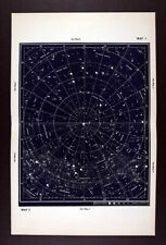
 c. 1842 Middleton Star Map Summer Constellations Hercules Bootes Virgo Scorpio
-
$23.47 CAD
 Vintage Soviet Union in Maps - Atlas - 1961 - Harold Fullard
-
$386.58 CAD
 c. 1842 Middleton Star Map Autumn Fall Constellations Pegasus Aquarius Andromeda
-
$28.55 CAD
 Vintage 1967 Rand McNally Atlas Map ~ SOVIET UNION, MONGOLIA, ARCTIC OCEAN
-
$38.64 CAD
 1960 Lunar Moon Map Photo Tranquillitatis B4-d Tranquility Bay Apollo - McDonald
-
$41.41 CAD
 1969 Adriatic Sea Taunton Nautical Chart Map Italy Albania & Yugoslavia 1440 Map
-
$28.55 CAD
 Vintage 1967 Rand McNally Atlas Map ~ STATES of NEW MEXICO & ARIZONA ~ Free S&H
-
$386.58 CAD
 c. 1842 Middleton Star Map Spring Constellations Equitorial Hydra Leo Gemini Sky
-
$16.22 CAD
 1966 AFRICA Atlas Map, vintage World Book Atlas, color, African physical map
-
$16.22 CAD
 1966 NE AFRICA Atlas Map, vintage World Book Atlas, color Libya Egypt Tunisia
-
$16.22 CAD
 1966 ASIA Atlas Map, vintage World Book Atlas, full color, Asian political map
-
$55.23 CAD
 1962 Becvar Star Map 4 North Sky Chart Hercules Bootes Corona Borealis Astronomy
-
$41.42 CAD
 Nova Totivs Terrarvm Orbis Geographica Tabvla Silver Foil World Map Framed
-
$131.16 CAD
 الأرض 1962 Vintage World Hafez Atlas maps اطلس خرائط اطلس حافظ Arabic
-
$386.58 CAD
 c. 1842 Middleton Star Map North Sky Polaris Pole Constellations Draco Cepheus
-
$12.15 CAD
 Life Pictorial Atlas of the World Hardcover 1961
-
$302.36 CAD
 Vintage World Atlas Map Atlas Political Map World, Classroom Map
-
$26.94 CAD
 Vintage UNITED STATES Railroad Map US Railway 1960s Original Wall Art Decor
-
$55.23 CAD
 1962 Becvar Star Map 9 Equatorial Sky Chart Libra Virgo Bootes Nebula Astronomy
-
$69.03 CAD
 1969 Vintage Arabic World Atlas Maps الاطلس الأطلس العربي العربى خرائط 📚
-
$33.14 CAD
 1972 Gall & Inglis Star Map 5 Equator Sky Cassiopeia Perseus Orion Taurus Fornax
-
$172.58 CAD
 VINTAGE 1970's Marion County Florida Real Estate Atlas MAPS/PLATS
-
$66.27 CAD
 1962 Becvar Star Map X Equatorial Sky Chart Milky Way Nebula Aquila Astronomy
-
$16.22 CAD
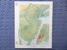 1966 NEW JERSEY Atlas Map, vintage World Book Atlas, full color
-
$16.22 CAD
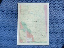 1961 ALBERTA CANADA Atlas Map, vintage Time Life Rand McNally Atlas, full color
-
$16.22 CAD
 1966 ANTARCTIC EXPLORATIONS Atlas Map, vintage World Book Atlas color South Pole
-
$16.22 CAD
 1961 QUEBEC CANADA Atlas Map, vintage Time Life Rand McNally Atlas, full color
-
$69.02 CAD
 1960's Vintage United States Map Antique Rand McNally World Maps Original Mailer
-
$66.27 CAD
 1962 Becvar Star Map 5 North Sky Chart Milky Way Lacerta Galactic Astronomy
-
$38.66 CAD
 1961 County Maps Upper Peninsula Region 1 Michigan Dept Conservation
-
$36.34 CAD
 1969 Pictorial Map ~ POLITICAL ADMINISTRATIVE DIVISIONS of the USSR A. Nazaroff
-
$28.55 CAD
 Vintage 1967 Rand McNally Atlas Map ~ STATE of FLORIDA ~ Free S&H
-
$28.55 CAD
 Vintage 1967 Rand McNally Atlas Map ~ STATE of COLORADO ~ Free S&H
-
$16.22 CAD
 1961 BRITISH COLUMBIA CANADA Atlas Map, vintage Time Life Rand McNally Atlas
-
$103.53 CAD
 1960 HAMMOND'S CLEAR RELIEF LARGE WALL ATLAS BOOK WORLD MAPS SCHOOL STUDENT
-
$138.06 CAD
 1961 County Maps Upper/Lower Peninsula Region 1, 2, 3 Michigan Dept Conservation
-
$66.27 CAD
 1962 Becvar Star Map 1 North Sky Chart Pole Polaris Cepheus Milky Way Astronomy
-
$27.60 CAD
 1960 USGS Topographical Map - Emsworth Quadrangle Pennsylvania - Pittsburgh Topo
-
$6.89 CAD
 Vintage Rand McNally World Atlas 1964-Learn Teach Maps-No Missing Pages12.5x9.5”
-
$33.14 CAD
 1961 Gall & Inglis Star Map Equator Ecliptic Auriga Capella Perseus Orion Taurus
-
$36.34 CAD
 Vintage 1969 Pictorial Map ~ UKRAINE, CRIMEA, MOLDAVIA, USSR ~ Free S&H
-
$66.27 CAD
 1962 Becvar Star Map 7 Equatorial Sky Chart Milky Way Monoceros Orion Astronomy
-
$55.23 CAD
 1962 Becvar Star Map 6 Equatorial Sky Chart Pisces Cetus Aires Glactic Astronomy
-
$27.60 CAD
 1961 Gall & Inglis Star Map Equator Ecliptic Ursa Major Leo Virgo Crater Corvus
-
$386.58 CAD
 c. 1842 Middleton Star Map Winter Constellations Aires Taurus Cetus Orion Lepus
-
$33.14 CAD
 1972 Gall & Inglis Star Map South Polar Sky Southern Cross Vela Tucana Phoenix
-
$10.66 CAD
 Vintage Atlas World Book Map Tennessee Or Texas USA State 1962 Page 11inx14in
-
$6.90 CAD
 Atmosphere Breakdown Poster
-
$36.34 CAD
 Vintage 1969 Pictorial Map ~ THE CAUCASUS, USSR ~ Free S&H
-
$20.70 CAD
 1960's Vintage Ireland or Scotland Colored Atlas Map - Hammond's Library Atlas
-
$36.34 CAD
 1969 Pictorial Map ~ THE VOLGA REGION, USSR ~ A. Nazaroff & T. LoPrete ~Free S&H
-
$10.66 CAD
 Vintage Atlas World Book Map Germany Or Belgium NetherlandsEurope Page 11inx14in
-
$16.22 CAD
 1966 SPAIN + PORTUGAL Atlas Map, vintage World Book Atlas, full color
-
$28.55 CAD
 Old Vintage 1967 Rand McNally Atlas Map ~ STATE of LOUISIANA ~ Free S&H
-
$16.22 CAD
 1966 PUERTO RICO+VIRGIN ISLANDS Atlas Map, vintage World Book Atlas, full color
-
$33.14 CAD
 1972 Gall & Inglis Star Map 3 Equator Sky Cassiopeia Andromeda Aquarius Perseus
-
$38.64 CAD
 1962 Becvar Star Map XII Equatorial Sky Chart Phoenix Fornax Nebula Astronomy
-
$16.22 CAD
 1966 ALBERTA CANADA Atlas Map, vintage World Book Atlas, full color
-
$44.17 CAD
 1962 Becvar Star Map Astronomy South Sky Sagittarius Corona Australis Milky Way
-
$36.34 CAD
 1969 Pictorial Map ~ THE EUROPEAN NORTH, USSR ~ A. Nazaroff & T. LoPrete
-
$28.55 CAD
 Vintage 1967 Rand McNally Atlas Map ~ NEW BRUNSWICK, NOVA SCOTIA, PEI, CANADA
-
$28.55 CAD
 Vintage 1967 Rand McNally Atlas Map ~ SYRIA, IRAQ, TURKEY, GREECE, EGYPT, LIBYA
-
$16.22 CAD
 1966 TEXAS Atlas Map, vintage World Book Atlas, full color
-
$28.55 CAD
 Old Vintage 1967 Rand McNally Atlas Map ~ STATE of MISSISSIPPI ~ Free S&H
-
$28.55 CAD
 Old Vintage 1967 Rand McNally Atlas Map ~ STATE of SOUTH CAROLINA ~ Free S&H
-
$41.42 CAD
 Vintage 1965 Queen Elizabeth National Park Uganda Africa Safari Map Original
-
$1034.44 CAD
 Ohio History Vintage Downtown Columbus Atlas/Maps From Sanborn Vol. 1 Very Rare
-
$16.22 CAD
 1966 JAPAN + KOREA Atlas Map, vintage World Book Atlas, full color
-
$16.22 CAD
 1966 POLAND + CZECHOSLOVAKIA Atlas Map, vintage World Book Atlas, full color
-
$33.14 CAD
 1972 Gall & Inglis Star Map 1 North Sky Polaris Cassiopeia Ursa Major Milky Way
-
$66.26 CAD
 1962 Becvar Star Map Astronomy South Pole Sky Hydrus Apus Carina Indus Milky Way
-
$28.55 CAD
 Old Vintage 1967 Rand McNally Atlas Map ~ STATE of WASHINGTON ~ Free S&H
-
$66.27 CAD
 1962 Becvar Star Map 2 North Sky Chart Milky Way Andromeda Perseus Astronomy
-
$28.55 CAD
 Old Vintage 1967 Rand McNally Atlas Map ~ STATE of WYOMING ~ Free S&H
-
$55.21 CAD
 1962 Becvar Star Map XIII Astronomy South Sky Chart Milky Way Centaurus Lupus
-
$55.21 CAD
 1962 Becvar Star Map XIV Astronomy South Sky Chart Vela Centaurus - Milky Way
-
$36.34 CAD
 1969 Pictorial Map ~ THE BALTIC, REPUBLICS, KALININGRAD, BELORUSSIA, USSR
-
$27.60 CAD
 1961 Gall & Inglis Star Map Equator Ecliptic Cassiopeia Pegasus Andromeda
-
$55.23 CAD
 1962 Becvar Star Map 8 Equatorial Sky Chart Milky Way Hydra Sextans Astronomy
-
$28.55 CAD
 Vintage 1967 Rand McNally Atlas Map ~ ASIA, SOVIET UNION, CHINA, SAUDI ARABIA
-
$55.23 CAD
 1962 Becvar Star Map XI Equatorial Sky Chart Milky Way Nebula Aquarius Astronomy
-
$33.14 CAD
 1972 Gall & Inglis Star Map 9 Equator Sky Ursa Major Virgo Corvus Centaurus Leo
-
$55.23 CAD
 1962 Becvar Star Map 3 North Sky Chart Milky Way Orion Ursa Maior Leo Astronomy
-
$33.14 CAD
 1972 Gall & Inglis Star Map 7 Equator Sky Lync Gemini Hydra Puppis Canis Major
-
$28.55 CAD
 Vintage 1967 Rand McNally Atlas Map ~ NEWFOUNDLAND, LABRADOR, CANADA
-
$33.14 CAD
 1972 Gall & Inglis Star Map 11 - Equator Sky Corona Bor Serpens Libra Scorpius
-
$33.14 CAD
 1972 Gall & Inglis Star Map 13 -Equator Sky Sagittarius Capricorn Hercules Draco
-
$37.48 CAD
 1965 Vernon Quinn Pictorial Map ~ MEXICO ~ Maps by Da Osimo ~ Free S&H
-
$28.55 CAD
 Old 1969 Pictorial Map ~ THE CENTRAL INDUSTRIAL REGION, USSR ~ Free S&H
-
$28.55 CAD
 Vintage 1967 Rand McNally Atlas Map ~ SAUDI ARABIA, EUROPE, AFRICA ~ Free S&H
-
$16.22 CAD
 1961 MANITOBA CANADA Atlas Map, vintage Time Life Rand McNally Atlas, full color
-
$16.22 CAD
 1966 SOUTHERN AFRICA Atlas Map, vintage World Book Atlas, color , Madagascar
-
$16.22 CAD
 1966 GEORGIA Atlas Map, vintage World Book Atlas, full color
-
$16.22 CAD
 1966 CONNECTICUT + RHODE ISLAND Atlas Map, vintage World Book Atlas, full color
-
$16.22 CAD
 1961 CANADA Atlas Map, vintage Time Life Rand McNally Atlas, full color


