 Antiques (CA)
Africa Maps
Asia Maps
Australia/Oceania Maps
Celestial Maps
Central America/Caribbean Maps
Curiosities Maps
Digital Maps
Europe Maps
Map & Globe Mixed Lots
Map & Globe Reproductions
North America Maps
South America Maps
World & Celestial Globes
World Maps

-
$72.58 CAD

 Map Farmington Falls Maine USGS 1968 Topographic Geo 1:24000 27x22" TOPO15
-
$72.58 CAD
 Map Kezar Falls Maine New Hampshire USGS 1964 Topographic 1:24000 27x22" TOPO16
-
$88.14 CAD
 1964 DENOYER GEPPERT H12 EUROPE 1648 FOLDING CLOTH SCHOOL MAP 33" x 43.5"
-
$36.28 CAD
 Map Brownfield Maine NH USGS 1964 Topographic Geological 1:24000 27x22" TOPO12
-
$11.05 CAD
 1965 Panoramic Map ALPS Matterhorn Austria Italy Switzerland Chamonix St. Moritz
-
$33.19 CAD
 Lot Of 3 Vintage 1960 Giant Wall Maps Lithographs Mankind, World, Solar System
-
$200.50 CAD
 Antique Grapes Lithography print school chart Vintage Cardboard print wall map
-
$138.27 CAD
 1928 / 1963 Yosemite National Park and Vicinity U.S. Geological Survey Map
-
$302.82 CAD
 Vintage World Atlas Map Atlas Political Map World, Classroom Map
-
$36.28 CAD
 Map New Sharon Maine 1968 Topographic Geological Survey 1:24000 27 x 22" TOPO9
-
$96.79 CAD
 Vintage Ravens school print, Original Cardboard Wall Map Kids Room Decoration
-
$96.79 CAD
 Rare 1960s Storks school nursery print, Original Cardboard School Chart
-
$33.19 CAD
 1972 Gall & Inglis Star Map 5 Equator Sky Cassiopeia Perseus Orion Taurus Fornax
-
$36.28 CAD
 Map Wayne Maine 1966 Topographic Geological Survey 1:24000 27x22" TOPO11
-
$31.10 CAD
 Map West Sumner Maine USGS 1967 Topographic Vintage Geo 1:24000 27x22" TOPO11
-
$36.28 CAD
 Map North Waterford Maine 1963 Topographic Geo Survey 1:24000 27x22" TOPO10
-
$36.28 CAD
 Map Greenwood Maine USGS 1967 Topographic Geological 1:24000 27x22" TOPO14
-
$36.28 CAD
 Map Bristol Maine USGS 1969 Topographic Geological 1:24000 27x22" TOPO18
-
$36.28 CAD
 Map Bryant Pond Maine USGS 1967 Topographic Vtg Geological 1:24000 27x22" TOPO12
-
$36.28 CAD
 Map Turner Center Maine 1967 Topographic Geo Survey 1:24000 27 x 22" TOPO4
-
$44.25 CAD
 Dinosaur National Monument Geological Survey Map 1965 - USGS - 50" x 30" - VG
-
$96.79 CAD
 Rare 1960s Crocodile School Print, Vintage Cardboard Print, Wall Chart
-
$27.64 CAD
 1965 Laminated Alps Map Europe's Backbone National Geographic
-
$11.05 CAD
 1965 Map TOP OF THE WORLD North Pole Arctic Circle T-3 Ice Island Glaciers Peary
-
$36.28 CAD
 Map North Waterford Maine 1963 Topographic Geo Survey 1:24000 27x22" #2 TOPO10
-
$27.64 CAD
 WILLIAM SHAKESPEARE Map GREAT BRITAIN England Scotland Wales Castles John Speed
-
$24.82 CAD
 Vintage USGS Topo Map Blackcap Mountain Maxon Dome Fresno,CA 1962 Original Chart
-
$33.19 CAD
 1961 Gall & Inglis Star Map Equator Ecliptic Auriga Capella Perseus Orion Taurus
-
$36.28 CAD
 Map East Andover Maine 1968 Topographic Geological Survey 1:24000 27 x 22" TOPO5
-
$36.28 CAD
 Map West Paris Maine USGS 1967 Topographic Vintage Geo 1:24000 27x22" TOPO11
-
$36.28 CAD
 Map Wilton USGS Maine 1968 Topographic Vintage Geo Survey 1:24000 27x22" TOPO11
-
$36.28 CAD
 Map Quill Hill Maine 1969 Topographic Geological Survey 1:24000 27 x 22" TOPO7
-
$31.10 CAD
 Map Black Mountain Maine USGS 1969 Topographic Geological 1:24000 27x22" TOPO17
-
$36.28 CAD
 Map Center Lovell Maine USGS 1963 Topographic Geological 1:24000 27x22" TOPO15
-
$31.10 CAD
 Map Oxbow Maine 1965 Topographic Geological Survey 1:62500 22 x 18" TOPO3
-
$96.79 CAD
 Antique Nuts School Print, Original Cardboard school chart, School Votanical Map
-
$33.19 CAD
 1972 Gall & Inglis Star Map South Polar Sky Southern Cross Vela Tucana Phoenix
-
$27.64 CAD
 1961 Gall & Inglis Star Map Equator Ecliptic Ursa Major Leo Virgo Crater Corvus
-
$36.28 CAD
 Map Mount Blue Maine 1968 Topographic Geological Survey 1:24000 27 x 22" TOPO6
-
$31.10 CAD
 Map Cornish Maine 1964 #2 Topographic Geological Survey 1:24000 27 x 22" TOPO5
-
$7.59 CAD
 NEW HAMPSHIRE OFFICIAL AUTOMOBILE HIGHWAY ROAD MAP 1968 VINTAGE TRAVEL TOURISM
-
$110.62 CAD
 1960 Photographic Moon Map x4 Lunar Surfice Photo Field Biela B8 Surface Craters
-
$309.74 CAD
 1960s Rare Pull-Down Classroom Map of Greece - Vintage School Wall Chart
-
$31.10 CAD
 Map Ellis Pond Maine 1968 Topographic Geological Survey 1:24000 27 x 22" TOPO5
-
$33.19 CAD
 1972 Gall & Inglis Star Map 3 Equator Sky Cassiopeia Andromeda Aquarius Perseus
-
$36.28 CAD
 Map Rumford Maine 1969 Topographic Geological Survey 1:24000 27 x 22" TOPO7
-
$36.28 CAD
 Map Mount Zircon Maine 1967 Topographic Geo Survey 1:24000 27 x 22" TOPO6
-
$421.59 CAD
 Rare 1960s Greek School Map, The Greek Alphabet chart, antique pull down map
-
$36.28 CAD
 Map Dixfield Maine 198 Topographic Geological Survey 1:24000 27 x 22" TOPO5
-
$36.28 CAD
 Map East Dixfield Maine 1968 Topographic Geo Survey 1:24000 27 x 22" TOPO5
-
$36.28 CAD
 Map Farmington Maine 1968 Topographic Geological Survey 1:24000 27 x 22" TOPO5
-
$2.75 CAD
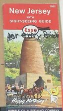 1961 Esso Travel Map of New Jersey
-
$36.28 CAD
 Map Cornish Maine 1964 Topographic Geological Survey 1:24000 27 x 22" TOPO5
-
$36.28 CAD
 Map Worthley Pond Maine 1967 Topographic Geo Survey 1:24000 27 x 22" TOPO6
-
$36.28 CAD
 Map Fayette Maine 1966 Topographic Geological Survey 1:24000 27 x 22" TOPO4
-
$36.28 CAD
 Map Weld Maine USGS 1968 Topographic Vintage Geological 1:24000 27x22" TOPO13
-
$36.28 CAD
 Map Pleasant Mountain Maine 1963 Topographic Geo Survey 1:24000 27 x 22" TOPO7
-
$31.10 CAD
 Map Hiram Maine USGS 1964 Topographic Geological 1:24000 27x22" TOPO14
-
$25.91 CAD
 Map Passadumkeag Maine 1960 Topographic Geological Survey 1:62500 21 x 17" TOPO2
-
$27.64 CAD
 1961 Six Maps and Charts of Shaviovik & Sagavanirktok Areal Geology map 48"X41"
-
$36.28 CAD
 Map Jim Pond Maine USGS 1969 Topographic Geological 1:24000 27x22" TOPO18
-
$36.28 CAD
 Map Roxbury Maine 1969 Topographic Geo Survey 1:24000 27 x 22" TOPO6
-
$31.10 CAD
 Map Mooseleuk Lake Maine 1963 Topographic Geo Survey 1:62500 22 x 18" TOPO2
-
$33.19 CAD
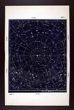 1972 Gall & Inglis Star Map 1 North Sky Polaris Cassiopeia Ursa Major Milky Way
-
$31.10 CAD
 Map Winn Maine 1960 Topographic Geological Survey 1:62500 21 x 17" TOPO2
-
$33.19 CAD
 1972 Gall & Inglis Star Map 11 - Equator Sky Corona Bor Serpens Libra Scorpius
-
$27.64 CAD
 1961 Gall & Inglis Star Map Equator Ecliptic Cassiopeia Pegasus Andromeda
-
$33.19 CAD
 1972 Gall & Inglis Star Map 9 Equator Sky Ursa Major Virgo Corvus Centaurus Leo
-
$33.19 CAD
 1972 Gall & Inglis Star Map 7 Equator Sky Lync Gemini Hydra Puppis Canis Major
-
$33.19 CAD
 1972 Gall & Inglis Star Map 13 -Equator Sky Sagittarius Capricorn Hercules Draco
-
$38.72 CAD
 1960 Lunar Moon Map Photo Fracastorius B6-c Lick Observatory Plate L18 Astronomy
-
$13.81 CAD
 WAYNESVILLE MISSOURI QUADRANT U.S. ARMY MAP SERVICE TOPOGRAPHIC ROAD MAP 1964
-
$20.74 CAD
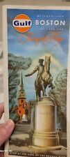 Vintage Antique 1966 Metropolitan Boston And Cape Cod Tourguide Map Gulf Mass
-
$109.51 CAD
 1960 Photographic Lunar Moon Map - 4 Photo Set - Field Crisium S. A4 - Craters
-
$38.72 CAD
 1960 Lunar Moon Map Photo Caucasus C2-e Pic Du Midi Observatory Crater Astronomy
-
$221.24 CAD
 RARE! GEO-PHYSICAL CULTURAL MAP of GREECE 42"x32" GREEK SCHOOL HUGE MAP 1960's
-
$48.40 CAD
 Rocky Mountain National Park CO Geological Survey Map 1961 USGS 38x28"
-
$109.51 CAD
 1960 Photographic Lunar Atlas Moon - 4 Photo Set - Field Byrgius F6 Surface
-
$96.78 CAD
 1960 Kokomo Indiana plat map
-
$109.51 CAD
 1960 Photographic Lunar Moon Map - 4 Photo Set - Field Tycho D7 Surface Crater
-
$482.58 CAD
 RARE Movie Poster WW2 Pearl Harbour Hiroshima CHINA JAPAN PHILIPPINES Far East
-
$44.23 CAD
 1960 Lunar Moon Map Photo Nubium N. D5-c Yerks Observatory Y160 Crater Astronomy
-
$27.65 CAD
 ALASKA -West Coast- Norton Sound to Bering Strait -1963 Used Original Large Map.
-
$109.51 CAD
 1960 Photographic Lunar Moon Map - 4 Photo Set - Field Reiner F4 Surface Craters
-
$13.81 CAD
 1969 Street Map of Medford, Oregon
-
$27.59 CAD
 Vintg 1967 Dept Of The Interior Geological Survey ALASKA MAP 48x36 w/ 25 pg List
-
$11.74 CAD
 HUMPHREY NEW YORK QUADRANT TOPOGRAPHIC SURVEY MAP 1961 CATTARAUGUS COUNTY
-
$518.53 CAD
 Grand Teton National Park Geological Survey Map 1968
-
$1.38 CAD
 Vintage 1963 National Geographic Map of Southwest Asia
-
$1.38 CAD
 Vintage 1961 National Geographic Map of Southeast Asia
-
$13.81 CAD
 EAST ANGLIA ENGLAND GREAT BRITAIN ORDNANCE SURVEY SHEET MAP 1962 VINTAGE
-
$274.93 CAD
 5x LARGE MAPS - NATIONAL ATLAS OF INDIA North South East West Central 1960'S
-
$11.74 CAD
 SALAMANCA NEW YORK QUADRANT TOPOGRAPHIC SURVEY MAP 1961 VINTAGE
-
$13.81 CAD
 1960 Wisconsin Official Highway Map
-
$20.67 CAD
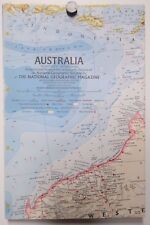 Vintage 1963 National Geographic Map of Australia
-
$13.81 CAD
 Atlantic Imperial Gas Pump Boston Tour Map 1961 Advertisement
-
$193.58 CAD
 Molina Campos calendar 1962 Alpargatas Gaucho Complete
-
$41.47 CAD
 ARGENTINA ATLAS & GEOGRAPHY 1966 FOLD-OUT MAPS SOUTH AMERICA
-
$276.54 CAD
5x LARGE MAPS - NATIONAL ATLAS OF INDIA North South East West Central 1960'S


