
-
$341.99 CAD

 Rand Mcnally & Company 1897 South America Map
-
$109.44 CAD
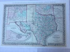 S.A Mitchell`s 1876 County Map of TEXAS~New Mexico Forts~Trails~Rails~23X34
-
$752.37 CAD
 Map UNITED COUNTIES LEEDS & GRENVILLE by Walling 1861 Rare Canada Map 5ft x 5ft
-
$93.02 CAD
 Framed 1868 Outline Map of Montgomery Co.,NY Published by Stranahan & Nichols
-
$1504.74 CAD
 1853 Colton’s Railroad & Township Map of New York
-
$677.14 CAD
 An Ancient Or Bible Map E Huntington Hartford Connecticut MEDITERRANEAN 1831
-
$25.65 CAD
 Wall Art Old Map of Vintage Mount Clemens Michigan Year 1881 11x14
-
$116.28 CAD
 Vtg 1966 Post Route 1896 South North Carolina Cumming Map Print 34”x22.5”
-
$30.03 CAD
 Vtg 1966 ~ Colton 1861 South North Carolina Topographical W.P. Cumming Map Print
-
$889.17 CAD
 B.F. Hathaway MAP OF GRANVILLE, WASHINGTON CO. NEW YORK 1894 Very Good 42x37
-
$123.05 CAD
 Barbour County Alabama Indian Territory Map 1832 RP 24x30" FREE SHIPPING!
-
$109.44 CAD
 Map & Bank Calendar, Comstock Lode, 1920s, Silver Mining, Nevada,
-
$68.40 CAD
 ANTIQUE 1800's ETCHING MAP OF THE NORTHERN PART OF THE UNITED STATES IN FRENCH
-
$102.60 CAD
 FLAT EARTH MAP : Alexander Gleason : circa 1892 Archival Quality Map Print
-
$564.28 CAD
 1803 Thomas Kitchin & Johannes Walch Large Antique Wall Map of England & Wales
-
$1208.45 CAD
 1822 Hein. Keller, panorama central Switzerland, aquatint with wash color 95cm
-
$886.43 CAD
 Antique Map of Hawaiian Islands Hawaii Trade with the US 1896 Imports Exports
-
$68.33 CAD
 Beautiful Original 1899 Maine Large Color Map/11x14/ GREAT WALL ART
-
$136.11 CAD
 Antique JOHN TALLIS & Co. SOUTH AMERICA MAP - Original, Hand Colored 1800's
-
$88.92 CAD
 U.S. Coast Survey 1865 North Carolina W.P. Cumming Map Print 17 1/2 x 38
-
$683.97 CAD
 S.D. Tilden NEW MAP OF CONNECTICUT 1871 Very Good 23x29
-
$4103.85 CAD
 Ensign Thayer MAP OF THE UNITED STATES WITH ITS TERRITORIES 1851 Very Good 35x32
-
$17.78 CAD
 1895 Map of Arizona AZ Antique vintage small 3.5” x 5.5” Home decor rare mini
-
$232.55 CAD
 NEW CALEDONIA SOUTH COAST 1861 (1893) VERY LARGE ANTIQUE SEA CHART
-
$1231.15 CAD
 1873 New Map of Connecticut, S.D. Tilden
-
$10259.61 CAD
 HOLY LAND MAP RARE CHICAGO LITHOGRAPH 1877 MARKS BIRDSEYE VIEW BETHLEHEM ISRAEL
-
$119.70 CAD
 Antique c.1900 Illinois railway map on linen railroad/train historical Chicago
-
$68.33 CAD
 Beautiful Original 1899 Indiana Large Color Map/10x14/ GREAT WALL ART
-
$338.98 CAD
 School Wall Map School Map Central Europe Deutscherbund 1815-1866 195x135
-
$339.48 CAD
 Wall Map Germany Prussia Friedrich the Great Austria -1801 196x204 1967
-
$40.97 CAD
 Vintage 1889 SAN JOSE CA Army Topographic Wall Map 17"x20" OLD! Silicon Valley!
-
$59.00 CAD
 Antique Color MAP - RUSSIA IN EUROPE, UKRAINE, SWEDEN & NORWAY & HOLLAND - 1863
-
$164.15 CAD
 EUROPE by DUFOUR 1841 LARGE ANTIQUE ENGRAVED WALL MAP ON LINEN 19th CENTURY
-
$957.56 CAD
 EUROPE -POLAND 1835 CHARLES PICQUET ANTIQUE WALL MAP ON LINEN WITH BOX
-
$1504.74 CAD
 PARIS 1851 ANTIQUE DECORATIVE WALL MAP IN COLORS by DANLOS 19TH CENTURY
-
$3761.86 CAD
 H.F. Walling MAP OF THE TOWNS OF GLOUCESTER AND ROCKPORT 1851 Very Good 36x46
-
$25.59 CAD
 Brazos county, Texas Old Wall Map Reprint Of Land Owners 1800s 22 1/8" x 17 1/8"
-
$410.38 CAD
 CATHOLIC CANADA 1893 G. BAILLAIRGE VERY LARGE ANTIQUE MAP 19TH CENTURY
-
$20.52 CAD
 Antique 1913 NY Hamilton County Geological Topography Survey Map 16&1/2"x20"
-
$40.97 CAD
 Vintage 1893 Boston MA Army Topographic Wall Map Massachusetts 16"x20" COOL!!!!
-
$273.58 CAD
 LARGE 3-ft Linen-Backed Antique Map Southwestern Highlands, New Jersey, 1888
-
$68.33 CAD
 Beautiful Original 1899 Kansas Large Color Map/10x14/ GREAT WALL ART
-
$683.96 CAD
 ANTIQUE 1898 THE EMPIRE GROUP MAP New York New Jersey Pennsylvania 32”x 37”
-
$4103.85 CAD
 Anthony Finley MASSACHUSETTS, CONNECTICUT & RHODE ISLAND 1825 Very Good 17x21
-
$123.12 CAD
 FRANCE PARIS & ENVIRONS 19th CENTURY ANTIQUE WALL MAP by TARIDE
-
$65.66 CAD
 Los Angeles Ca. Stimson Block 1894 Art/Lithographed By Bruce Wellington Pierce
-
$3009.49 CAD
 Italy, Switzerland, Austria Map Arrowsmith, Aaron wall map
-
$3419.87 CAD
 Case and Waters MAP OF THE WORLD 1834 Very Good 16x26
-
$46373.50 CAD
 The Suzhou Astronomical Chart, Tienwen Tu, China, Chinese, History, Rare
-
$17.10 CAD
 1895 Iowa Map IA Antique vintage small 3.5” x 5.5” Home decor rare mini Maps
-
$478.78 CAD
 CHATHAM ISLANDS NEW ZEALAND 1890 LARGE ANTIQUE SEA CHART 19TH CENTURY
-
$17.10 CAD
 1895 Georgia Map GA Antique vintage small 3.5” x 5.5” Home decor rare Maps
-
$17.10 CAD
 1895 Illinois Map IL Antique vintage small 3.5” x 5.5” Home decor rare mini
-
$820.77 CAD
 E.M. Woodford SMITH'S MAP OF HARTFORD COUNTY CONNECTICUT 1855 Good 59x46
-
$68.33 CAD
 Beautiful Original 1899 Utah Large Color Map/10x14/ GREAT WALL ART
-
$30.03 CAD
 Vtg 1966 Bachmann 1896 Birds Eye View N.S. Carolina Topographical WP Cumming Map
-
$232.55 CAD
 AMERICA by DUFOUR 1841 LARGE ANTIQUE ENGRAVED WALL MAP ON LINEN 19th CENTURY
-
$4787.82 CAD
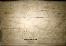 J.W. Mott L.H Cramer MAP OF THE TOWN OF SARATOGA SPRINGS NY 1879 Very Good 33x51
-
$68.40 CAD
 ANTIQUE 1855 J. H. COLTON NO. 22 PENNSYLVANIA COUNTY MAP FRAMED & MATTED
-
$1573.14 CAD
 PARIS FRANCE VERY LARGE PICTORIAL MAP 1845 by VUILLEMIN 19TH CENTURY ON LINEN
-
$68.38 CAD
 Large 55 X 40 C 1902 Rand McNally Sectional Case Map: North America-Great Color!
-
$17.10 CAD
 1895 Indiana Map IN Antique vintage small 3.5” x 5.5” Home decor rare mini
-
$54.65 CAD
 LARGE Historic 1838 City of Cincinnati OHIO Street WALL Map BY JOSEPH GEST PRINT
-
$547.18 CAD
 FRANCE & COLONIAL ARMY 1890 ANTIQUE WALL MAP LE PETIT JOURNAL ON LINEN
-
$2735.90 CAD
 Roderick Nevers STATE OF CONNECTICUT PARTS OF NY AND NJ 1851 Very Good 23x28
-
$451.42 CAD
 1940 Denoyer-Geppert Wall Map of Secession before the American Civil War
-
$786.57 CAD
 Antique 1852 Israel Andrews 'MAP of the RAILROADS of the UNITED STATES' - Trains
-
$47.86 CAD
 1878 Antique NEW JERSEY Town Map/BRIGHTON, WALL TOWNSHIP, MONMOUTH COUNTY
-
$351.22 CAD
 PAIR 1801 Engraved Map John Cary TURKEY: ASIA & EUROPE Hand-Color Folios
-
$4787.82 CAD
 Henry Francis Walling MAP OF MIDDLESEX COUNTY MASSACHUSETTS 1856 Excellent 58x60
-
$506.14 CAD
 LONDON LARGE WALL MAP 1894 SMITH & SON 19TH CENTURY ON LINEN IN ITS POCKET-BOOK
-
$13.68 CAD
 Vintage Wappingers Falls NY c1889 Panorama Map sold by Historical Society
-
$205.19 CAD
 1830c Huge map of South America 120x100cm. (Incomplete)
-
$273.58 CAD
 LARGE 3-ft Linen-Backed Original Antique Map Egg Harbor Area New Jersey, 1888
-
$123.05 CAD
 Historic Map of Paris France 1864 Garnier Monument Street wall map art print
-
$136.73 CAD
 Beautiful Original 1899 Washington DC Map/ GREAT WALL ART
-
$68.33 CAD
 Beautiful Original 1899 Illinois Large Color Map/10x14/ GREAT WALL ART
-
$273.58 CAD
 LARGE 3-ft Linen-Backed Original Antique Map Camden Area, New Jersey, 1888
-
$68.33 CAD
 Beautiful Original 1899 Vermont Large Color Map/11x14/ GREAT WALL ART
-
$68.33 CAD
 Beautiful Original 1899 Louisana Large Color Map/10x14/ GREAT WALL ART
-
$1915.13 CAD
 PARIS 1836 VERY LARGE ANTIQUE DECORATIVE MAP by TOUSSAINT 19TH CENTURY
-
$68.33 CAD
 Beautiful Original 1899 Eastern Hemisphere Large Color Map/10x14/ GREAT WALL ART
-
$54.72 CAD
 Cedar Keys Florida Coast 1861 U.S. Coast Survey map. Note Tear In Left 1/3
-
$1641.54 CAD
 MAP of South Africa 1800s ORIGINAL
-
$68.33 CAD
 Beautiful Original 1899 North Dakota Large Color Map/10x14/ GREAT WALL ART
-
$68.33 CAD
 Beautiful Original 1899 Missouri Large Color Map/10x14/ GREAT WALL ART
-
$1641.54 CAD
 Large Antique French 1863 A.H.Dufour Map of North America Linen back
-
$68.33 CAD
 Beautiful Original 1899 Manitoba Large Color Map/10x14/ GREAT WALL ART
-
$68.33 CAD
 Beautiful Original 1899 Washington State Large Color Map/10x14/ GREAT WALL ART
-
$2995.81 CAD
 Plan of Tarrytown and Vicinity Wall Map. 1868
-
$615.58 CAD
 LONDON LARGE CRUCHLEY'S FOLDING MAP c. 1878 19TH CENTURY ON LINEN IN POCKET-BOOK
-
$478.89 CAD
 School Wall Map Austria 1815-1923 History 78 11/16x64 3/16in Vintage~1960
-
$2599.09 CAD
 RARE Antique 1833 1st Edition Reference & Distance Map New Hampshire JR Goodno
-
$34.20 CAD
 Rand, McNally Indexed Atlas of the World Map of Japan 1892
-
$820.77 CAD
 PARIS LARGE WALL MAP 19TH CENTURY by MALTE-BRUN ON LINEN IN HIS POCKET-BOOK
-
$68.33 CAD
 Beautiful Original 1899 Quebec Large Color Map/10x14/ GREAT WALL ART
-
$17.10 CAD
 1895 Map of Alaska AK Antique vintage small 3.5” x 5.5” Home decor rare mini
-
$3761.86 CAD
 1855 Colton Wall Map of Maine
-
$1196.96 CAD
 SCARCE Antique 1888 'Map of the Town of ANDOVER Massachusetts' Wall Map
-
$109.44 CAD
 FRANCE CARTE ROUTIERE ET POSTALE 1888 by DUFOUR TRES GRANDE CARTE MURALE


