 Antiques (CA)
Africa Maps
Asia Maps
Australia/Oceania Maps
Celestial Maps
Central America/Caribbean Maps
Curiosities Maps
Digital Maps
Europe Maps
Map & Globe Mixed Lots
Map & Globe Reproductions
North America Maps
South America Maps
World & Celestial Globes
World Maps

-
$27.50 CAD

 Map War Of 1812 Indian Wars 1871 Victorian Lithograph History Swinton DWAA12
-
$27.50 CAD
 1879 Map Rhode Island United States Victorian Geography 1st Edition DWAA9
-
$20.63 CAD
 Map Revolutionary War South Colonies 1871 Victorian Woodcut Print History DWAA12
-
$27.50 CAD
 Map Of Original 13 Colonies 1871 Victorian Lithograph History Swinton DWAA12
-
$563.91 CAD
 1826 MAP of the UNITED STATES Oregon Territory Mexico Texas no Canada America
-
$171.94 CAD
 1877 F. V. Hayden Parts of Western Wyoming and Southeastern Idaho Map
-
$240.72 CAD
 1875 Map Yellowstone Montana Captain William Ludlow US Army Corps Engineers
-
$40.92 CAD
 1860 ORIGINAL MAP - Europe Asia Showing Extent of Alexander the Great Empire
-
$15.13 CAD
 1897 MAP OF EUROPEAN TURKEY Original antique Greece Armenia Serbia Bulgaria
-
$16.51 CAD
 1897 BAEDEKER MAP - Germany Hamburg & Environs
-
$28.93 CAD
 1897 BAEDEKER MAP - WALES between Bangor & Tremadog
-
$4.13 CAD
 1897 Map of Tyrol aka Trentino antique print Austria Italy
-
$6.88 CAD
 1897 MAP OF THE HISTORY OF EUROPEAN TURKEY Original antique Greece
-
$42.35 CAD
 1847 Vuillemin Antique Map The Turkish Empire in Europe from Greece to Austria
-
$27.50 CAD
 1879 Map German Empire Netherlands Belgium Victorian Geography 1st Ed DWAA9
-
$453.79 CAD
 ANTIQUE 1857 J&F TALLIS MAP OF CANADA MOST DECORATED PRE-CONFEDERATION EXAMPLE
-
$20.63 CAD
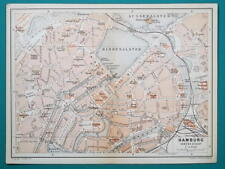 1897 BAEDEKER MAP - Germany HAMBURG City Plan + Railroads
-
$55.02 CAD
 1879 Map Maine United States New England Victorian Geography 1st Edition DWAA9
-
$6.88 CAD
 1897 MAP OF SPAIN & PORTUGAL Original antique print
-
$35.38 CAD
 1897 BAEDEKER MAP - Germany HAMBURG & ALTONA Good for Genealogy
-
$4.13 CAD
 1897 Map of STYRIA. antique print Austria
-
$6.88 CAD
 1896 Map of Sweden and Norway original antique print
-
$178.81 CAD
 1884 ANTIQUE MAP Indian Removal CHEROKEE NATION 32" Arkansas Kansas Missouri
-
$5.50 CAD
 1897 Map of KRAIN . antique print Slovenia Austria Italy
-
$6.88 CAD
 1896 Map of Switzerland antique print Swiss
-
$9.63 CAD
 1896 SALZKAMMERGUT. antique print Austria
-
$16.51 CAD
 1897 BAEDEKER MAP - Germany Dresden Tharandt & Environs
-
$51.16 CAD
 1860 MAP CENTRAL EUROPE - Empire of Austria Hungary Slovakia Czech Romania
-
$27.50 CAD
 Map Sherman's Army Virginia Operations 1871 Victorian Lithograph History DWAA12
-
$55.02 CAD
 1879 Map United States Physical Groups Victorian Geography 1st Edition DWAA9
-
$55.02 CAD
 1879 Map Dominion Of Canada East West Victorian Geography 1st Ed DWAA9
-
$55.02 CAD
 1879 Map United States Victorian Atlas Harpers Geography 1st Edition DWAA9
-
$41.25 CAD
 Map Territorial Growth Of United States 1871 Victorian Lithograph History DWAA12
-
$55.02 CAD
 1879 Map Of South America Brazil Victorian Geography 1st Edition DWAA9
-
$17.19 CAD
 1887 MAP PLAN BAEDEKER - Germany Bamberg & Kissingen 4 x 6" (10 x 15,5 cm)
-
$55.02 CAD
 1879 Map Mexico West Indies Central America Victorian Geography 1st Ed DWAA9
-
$40.92 CAD
 1860 ORIGINAL MAP - Europe Showing Extent of the Roman Empire
-
$55.02 CAD
 1879 Map West Pacific NW & Southwest Group Victorian Geography 1st Edition DWAA9
-
$48.14 CAD
 1879 Map North America Victorian Atlas Harpers Geography 1st Edition DWAA9
-
$43.85 CAD
 1897 MAP Baedeker - England & Wales Railways 15 x 16" (38 x 41 cm)
-
$6.88 CAD
 1896 Map of South part of Sweden and Norway original antique print
-
$30.26 CAD
 1897 BAEDEKER MAP - Germany Thuringen Forest Erfurt Weimar Gotha Zella Suhl
-
$55.02 CAD
 1879 Map Australia Colonies And Oceania Victorian Geography 1st Edition DWAA9
-
$16.51 CAD
 1897 BAEDEKER MAP - Germany Jena & Environs Saaletal
-
$51.16 CAD
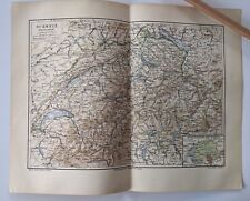
 SWITZERLAND + List of Cantons - 1860 Original Antique Map
-
$99.99 CAD
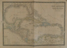 BRUÉ Map of Caribbean Carte des Isles Antilles des Etats Unis de L'Amérique 1860
-
$22.70 CAD
 1897 BAEDEKER MAP - Germany MUNSTER City Plan + Railroads
-
$55.02 CAD
 1879 Map Texas & Southern Plains States US Victorian Geography 1st Edition DWAA9
-
$16.51 CAD
 1897 BAEDEKER MAP - Germany Kiel Denmark Sondenburg & Environs
-
$55.02 CAD
 1879 Map US Mid Atlantic States Victorian Harpers Geography 1st Edition DWAA9
-
$19.26 CAD
 1887 MAP BAEDEKER - GERMANY Regensburg & Augsburg 4 x 6" (10 x 15,5 cm)
-
$67.40 CAD
 1863 Johnson's PALESTINE Antique Map Hand Colored 14 x 18"
-
$33.76 CAD
 1860 ORIGINAL MAP - Europe Middle East During the Crusades incl. Routes
-
$20.63 CAD
 Map War Secession West Operations 1871 Victorian Woodcut Print History DWAA12
-
$20.63 CAD
 Map War Of Secession East Coast 1871 Victorian Woodcut Print History DWAA12
-
$55.02 CAD
 1879 Map New England USA Victorian Atlas Harpers Geography 1st Edition DWAA9
-
$67.40 CAD
 1863 Johnson's Map of Maryland and Delaware District of Columbia 14 x 18"
-
$55.02 CAD
 1879 Map South Central Atlantic US Victorian Harpers Geography 1st Edition DWAA9
-
$81.16 CAD
 VOLNEY'S 1804 MAPS OF UNITED STATES & NORTH AMERICA ~ 2 MAPS ~ TEXAS MENTIONED
-
$51.16 CAD
 1860 ORIGINAL MAP - Europe During the French Revolution of 1789
-
$99.04 CAD
 Der Hauptpass durch den Balkan Antique Map Engraving Mountain Massif Veduta 1840
-
$51.16 CAD
 RUSSIA IN EUROPE - 1860 Original Antique Map
-
$43.80 CAD
 1838 MAP - ITALY Piedmont France Savoy Land of Neff 13.5 x 16.6" 34 x 42 cm
-
$55.02 CAD
 1879 Map Massachusetts Boston US Victorian Atlas Geography 1st Edition DWAA9
-
$30.87 CAD
 SWEDEN & Part of Denmark - 1885 Baedeker Map 9.5" x 14.5" (24 x 37 cm)
-
$94.91 CAD
 1862 Johnson Map of Austria, Turkey in Europe and Greece Hand Colored 18" x 26"
-
$19.95 CAD
 1897 BAEDEKER MAP - UNITED KINGDON Isle of Wight & Dorking Guildford Environs
-
$20.63 CAD
 1897 BAEDEKER MAP - Germany Harz Quedlinburg Wernigerode + Railroads
-
$39.78 CAD
 FRANCE In The Year 1570 To Illustrate St. Bartholomew Eve MAP Normandy Champagne
-
$130.68 CAD
 1886 Malte-Brun Ancient Asia Map
-
$16.51 CAD
 1887 MAP BAEDEKER - AUSTRIA Vienna & Environs + Plan of Laxenburg Castle & Park
-
$22.01 CAD
 IRELAND 1841 MAP - 8 x 10.5" (20 x 26 cm) Engraving Intaglio
-
$28.93 CAD
 1897 BAEDEKER MAP - Germany Czech Bohemia Border Decin Pirna Swiss Saxony
-
$16.51 CAD
 1897 BAEDEKER MAP - Germany Meissen & Environs + Railroads
-
$16.51 CAD
 1897 BAEDEKER MAP - Germany BREMEN City Plan + Railroads
-
$51.16 CAD
 SPAIN PORTUGAL - 1860 Original Antique Map
-
$30.87 CAD
 NORWAY - 1885 Baedeker Map 10" x 15" (25 x 38 cm)
-
$16.51 CAD
 1887 MAP BAEDEKER - GERMANY Bavarian Forest Bayersiche Wald
-
$19.95 CAD
 1897 BAEDEKER MAP - ENGLAND Worcester City Plan + Cathedral Ground Plan
-
$16.51 CAD
 1897 BAEDEKER MAP - Germany Altenstein Liebenstein Steinbach & Environs
-
$20.63 CAD
 1897 BAEDEKER MAP - Germany CHEMNITZ Zwickau Jachymov & Environs + Railroads
-
$43.78 CAD
 1844 ORIGINAL MAP - North America Physical Map Caribbean Islands Ocean Currents
-
$20.63 CAD
 1897 BAEDEKER MAP - Germany HANOVER & OSNABRUCK City Plan + Railroads Genealogy
-
$16.51 CAD
 1897 BAEDEKER MAP - Germany Blankenburg Allendorf SItzendorf & Environs
-
$52.27 CAD
 MOUNT GENEROSA Switzerland Panorama Mountain Map by Fedelo
-
$19.95 CAD
 1897 BAEDEKER MAP - ENGLAND Portsmouth City Plan & Chichester Cathedral Plan
-
$19.95 CAD
 1897 BAEDEKER MAP - WALES Wye River Ross Chepstow + Gloucester Cathedral Plan
-
$16.51 CAD
 1897 BAEDEKER MAP - Germany Eisenach & Environs
-
$16.51 CAD
 1897 BAEDEKER MAP - Germany Stralsund Town Plan + Rugen Island Putbus Stubbenitz
-
$51.16 CAD
 SCANDINAVIA Norway Sweden Finland Denmark Iceland - 1860 Original Antique Map
-
$20.63 CAD
 1897 BAEDEKER MAP - Germany HALLE City Plan + Railroads
-
$20.63 CAD
 1897 BAEDEKER MAP - Germany LEIPZIG City Plan + Railroads
-
$16.51 CAD
 1897 BAEDEKER MAP - Germany Wilhelmshohe & Environs
-
$30.87 CAD
 1887 MAP BAEDEKER - VIENNA City Center Plan Austria
-
$16.51 CAD
 1897 BAEDEKER MAP - Germany Friedrichroda Tabarz & Environs
-
$16.51 CAD
 1897 BAEDEKER MAP - Germany Bodetal Valley Thale & Environs
-
$130.68 CAD
 STICH & DRUCK c1888 Map Austrian Alps 20" x 16"
-
$110.03 CAD
 1879 Map Connecticut United States Victorian Atlas Geography 1st Edition DWAA9
-
$55.02 CAD
 1879 Map Asia Desert Arctic Peninsula Belt Victorian Geography 1st Edition DWAA9
-
$55.02 CAD
 1879 Map West Central States Group Victorian Atlas Geography 1st Edition DWAA9


