 Antiques (CA)
-
$383.77 CAD

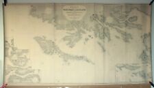
 Antique English Nautical Charts 1787 + 1794 Shetland Islands North Sea 1812
-
$205.60 CAD
 1952 US ARMY LAKE SURVEY CHARTS OF NEW YORK CANALS Erie Canal Champlain Seneca
-
$105.47 CAD
 Admiralty 3686 US-East Coast North Carolina Approaches To Morehead City MapChart
-
$118.49 CAD
 Admiralty 557 MAR DEL PLATA TO COMODORO RIVADAVIA ARGENTINA MARITIME Map Chart
-
$15.00 CAD
 GPS Garmin G2 chart card - GULF OF MEXICO VUS515L -BROWNSVILLE TX TO KEY LARGO
-
$12.99 CAD
 1918 MAP U.S. NAVY HYDROGRAPHIC OFFICE U.S. GULF COAST No 1112 - 30"x44"
-
$34.25 CAD
 Nautical Map of The East River NY Laminated 22” X Series 33” Great for framing
-
$34.25 CAD
 Nautical Map of The New York Harbor Laminated 23” X Series 29” Great for framing
-
$34.25 CAD
 Nautical Map Long Island Sound Laminated 16” X 35” Great for framing!
-
$14.09 CAD
 Sunken Buried Treasure Shipwreck Map Pirates Captain Kidd Blackbeard Calico Jack
-
$34.27 CAD
 Army Corps of Engineers Barge Canal Navigation Charts NY State 1964
-
$12.99 CAD
 1916 MAP U.S. NAVY HYDROGRAPHIC OFFICE- GREAT BAHAMA BANK No 26c - 28"x40"
-
$9.99 CAD
 1917 MAP U.S. NAVY HYDROGRAPHIC OFFICE IRELAND WEST COAST No 4437 - 49"x27"
-
$274.12 CAD
 Key West Harbor NOAA Florida Keys Nautical Chart 37 X 44 Rare 1986 Vintage GC FS
-
$105.47 CAD
 Admiralty 980 PHILIPPINE ISLANDS LUZON WEST COAST SUBIC BAY Map Chart Maritime
-
$131.51 CAD
 Admiralty 1950 NORTH ATLANTIC OCEAN ARQUIPELAGO DOS ACORES Map Chart Maritime
-
$34.25 CAD
 Nautical Map of The New York Harbor Laminated 22.5” X 30” Great for framing!
-
$34.25 CAD
 Nautical Map of City Island NY Laminated 18” X Series 34” Great for framing
-
$34.25 CAD
 Nautical Map New York Hudson & East Rivers Laminated 24” X 36” Great for framing
-
$34.25 CAD
 Nautical Map of The Harlem River NY Laminated 13” X Series 34” Great for framing
-
$26.85 CAD
 1859 Virginia and North Carolina Coast Survey Sketch D Section No. IV Progress
-
$34.20 CAD
 BBA Chart Kit, Florida West Coast and the Keys Region 8, 10th Edition
-
$68.52 CAD
 Vintage 1937 Barnes Bay To Key West Florida Nautical Chart Map Waterway FL Keys
-
$67.97 CAD
 1864 Coast Survey Chart, St. George's River and Muscle Ridge Channel Maine Map
-
$9.99 CAD
 ANTIQUE 1919 MAP U.S. NAVY HYDROGRAPHIC OFFICE ENGLISH CHANNEL No 4431 - 48"x30"
-
$34.25 CAD
 Nautical Map of The Hudson River NY Laminated 23” X Series 32” Great for framing
-
$47.97 CAD
 LOT OF NAVIGATIONAL CHARTS FLORIDA KEYS BIMINI AND MIAMI
-
$27.40 CAD
 Vintage Hydrographic Chart Phoenix Islands South Pacific Ocean 1943 WW2
-
$118.49 CAD
 Admiralty 1947 WASHINGTON ADMIRALTY INLET AND PUGET SOUND Map Chart Maritime
-
$80.87 CAD
 RI Mass 1973 nautical Noaa chart narragansett bay  36 by 48 navigation map
-
$105.47 CAD
 Admiralty 1499 UNTTED STATES ALASKA CROSS SOUND TO KODIAK ISLAND Map Chart Paper
-
$29.47 CAD
 Lot of 50+ VTG Lake Erie Fishing/Nautical Maps Chart Poster 29” x 23” See Pics
-
$41.04 CAD
 NAUTICAL CHART MAP #1124 WHITE HEAD ISLAND TO BERRY HEAD 1956-1967
-
$27.40 CAD
 VTG Hydrographic Chart Enderbury Island to Christmas Island Pacific Ocean 1940s
-
$16.26 CAD
 Nautical Chart Florida 1997 St. Lucie To Ft. Myers Lake Okeechobee
-
$34.25 CAD
 Nautical Map Mexico & Central America 1940 US Navy large 33" x 48" H.O. 1007
-
$25.00 CAD
 Antique Nautical Chart - Ca.1915 Nova Scotia Baccarro Point To Ram Island Map #3
-
$25.97 CAD
 Vancouver Island British Columbia Nautical Chart 3001 1971
-
$105.47 CAD
 Admiralty 8087 PORT APPROACH GUIDE AD DAMMAM ( Mina al Malik Abda al Aziz ) Map
-
$1082.81 CAD
 Antique 1889 / 1890 JAMES IMRAY Blueback Chart 31 : SCOTLAND AND LEWIS ISLANDS
-
$19.12 CAD
 1639 Virginia and New England Historic Vintage Style Wall Map - 16x24
-
$20.56 CAD
 Vintage 1960’s South Florida & Miami Area Fishing Charts 6 Maps Tackle Pub.
-
$18.61 CAD
 Vintage Navigational Condition Report Chart Kieler Forde Germany Nautical Chart
-
$24.60 CAD
 1583 Earliest European Sea Chart Historic Vintage Style Wall Map - 20x28
-
$34.25 CAD
 Nautical Map Hawaiian Islands North Pacific Ocean 1975 #19008 large 41" x 58"
-
$17.26 CAD
 1856 Papeete Island of Tahiti Tidal Observations U.S. Coast Survey Moon Phases
-
$9.99 CAD
 1919 MAP U.S. NAVY HYDROGRAPHIC OFFICE IRELAND SOUTH COAST No 4716 - 50"x30"
-
$13.57 CAD
 Vintage Vancouver Canada Washington Nautical Chart Map 1983 Haro Strait
-
$9.99 CAD
 ANTIQUE 1919 MAP U.S. NAVY HYDROGRAPHIC OFFICE LE HAVRE FRANCE No 4343 - 42"x29"
-
$36.94 CAD
 1639 Island of Cuba Caribbean Ocean Exploration Map - 24x42
-
$9.99 CAD
 1917 MAP U.S. NAVY HYDROGRAPHIC OFFICE ENGLISH CHANNEL WESTER No 4434 - 27"x42"
-
$12.99 CAD
 1916 MAP U.S. NAVY HYDROGRAPHIC OFFICE- BRITISH ISLANDS No 4430 - 28"x42"
-
$12.99 CAD
 1906 ADMIRAL LIVERPOOL JOHN BANKS & SONS - BRITISH CHANNEL No 1179 - 26"x60"
-
$68.52 CAD
 Vtg 1936 Pungo River To Topsail Sound North Carolina Nautical Chart Map Waterway
-
$9.99 CAD
 1917 MAP U.S. NAVY HYDROGRAPHIC OFFICE ENGLISH CHANNEL MIDDLE No 4433 - 28"x41"
-
$23.29 CAD
 Florida Soundings in Fathoms at mean low water Place mat Map Mercator projection
-
$12.99 CAD
 1916 MAP U.S. NAVY HYDROGRAPHIC OFFICE BAY OF BISCAY No 4321 - 36"x29"
-
$45.23 CAD
 Vintage 1962 Massachusetts Woods Hole Nautical Chart Map - 30” x 45”
-
$2535.70 CAD
 Antique 1926 Map of Nantucket by Tony Sarg
-
$27.34 CAD
 Vintage Nautical Map North Carolina Cape Hatteras, Cape Henry To Cape Fear
-
$37.01 CAD
 Vintage 1929 Mouths Of Roanoke River Nautical Map - 24.5” x 22”
-
$41.11 CAD
 Rare Vintage 1949 United States US Navy Military North Pacific Pilot Chart Map
-
$28.78 CAD
 NAVIGATIONAL CHART / MAP # 515 -MALI LOSINJ & PRIZNA TO ZADAR - YUGOSLAVIA
-
$34.27 CAD
 1986 Straits Of Florida & Approaches Chart Marine Soundings In Fathoms.43X36”
-
$45.22 CAD
 1965 Marine Geology 70 Pgs, Oceanographic Atlas North Atlantic, 18 Color Charts
-
$41.11 CAD
 Lot of 4 Vintage Nautical Charts Maps - Sandy Hook, Chesapeake Bay
-
$20.56 CAD
 Vintage 1960-1961 Lake Winnipesaukee Navigation Chart
-
$27.34 CAD
 Vintage Nautical Map Chesapeake Bay Maryland Mercator Projection
-
$23.30 CAD
 Vintage Bahamas Nautical Sketch Chart Map - Elizabeth Harbour To Hog Cay - 11x17
-
$4.10 CAD
 Vtg Nautical Chart: C&GS 880/879 Louisiana Intracoastal Waterway
-
$34.25 CAD
 Nautical Map Prince of Whales Channel & Approaches # 74292 1972 US Navy 36"x 53"
-
$19.12 CAD
 1650 Map of California shown as an Island! Unusual Error Map - 16x24
-
$34.25 CAD
 Nautical Map New Guinea Banda Sea to Solomon Island 1969 #630 large 36" x 54"
-
$34.25 CAD
 Nautical Map Fiji Islands Kandavu Island & Passage 1949 # H.O.2858 33" x 48"
-
$75.37 CAD
 1930 Nautical Chart Map South Atlantic Ocean 1071 Map Feb 38th Ed. 54"x 36"
-
$4.10 CAD
 Vtg Nautical Chart: C&GS 1253 East Cape to Mormon Key
-
$98.69 CAD
 1888 Chart of the Pacific Coast from San Diego to Pt. Buchon, Season of 1888-89
-
$24.67 CAD
 Chart Kit Norfolk VA to Jacksonville FL Intracoastal Cruising Sailing Map
-
$23.30 CAD
 NAUTICAL NAVIGATIONAL CHART # 11485 - TOLOMATO RIVER TO PALM SHORES - FLORIDA
-
$19.12 CAD
Sea Chart of Europe 1583 Vintage Style Navigational Map - 18x24
-
$23.30 CAD
 Vintage Bahamas Nautical Sketch Chart Map - Allan’s Highborne - 11x17
-
$27.40 CAD
 Vintage Hydrographic Chart Corinto Harbor West Nicaragua Central America WW2
-
$34.27 CAD
 Vintage Nautical Chart 12346 Hudson River Yonkers Piermont. NOAA 1984 24.5" x48
-
$6.85 CAD
 NOAA Chart 11466 Jupiter Inlet To Flowley Rocks
-
$1.36 CAD
 Vintage Nautical Chart 14851 Michigan Lake St Clair 4th ed Aug 1975 NOAA
-
$20.56 CAD
 NAVIGATIONAL CHART # 3102 - TAKORADI & SEKONDI BAY W. COAST AFRICA GHANA - 1967
-
$45.23 CAD
 Vintage 1931 Approaches To Cape Fear River Nautical Chart Map - 45.5” x 35”
-
$34.25 CAD
 Nautical Tracking Chart #5405-44M 1963 large 36" x 54"
-
$50.71 CAD
 Vintage 1928 Cape Hatteras Wimble Shoals Ocracoke Inlet Nautical Map - 44” x 36”
-
$16.26 CAD
 Nautical Chart Florida 1995 Palm Shores To West Palm Beach
-
$5.48 CAD
 Chart of the Alaska Coast - 1593 - de Corneille - Navigational Map - 13”x9.75”
-
$47.97 CAD
 1947 Tidal Current Charts Long Island Sound & Block Island Sound 6 Pgs/12 Charts
-
$50.71 CAD
 Vintage 1960 Deer Island Casco Passage Maine Nautical Chart Map - 35”x 22”
-
$30.00 CAD
 Antique Nautical Chart - Ca.1916 New York Bay & Harbour Map #11
-
$19.12 CAD
 1639 “Atlantic Coast of North America” Vintage Style Early Land Map - 16x24
-
$32.90 CAD
 Vintage Nautical Chart # 14965 Lake Superior Redridge to Saxon Harbor 1976
-
$61.68 CAD
 Vintage Nautical Charts Maine Casco Bay • Large 46"x36"
-
$23.30 CAD
 Vintage Bahamas Nautical Sketch Chart Map - Rum Cay - 11x17
-
$253.57 CAD
 ORIGINAL ANTIQUE MAP NAUTICAL CHART Bahama Islands Exuma Sound Eastern Approach
-
$105.47 CAD
 Admiralty 3150 MOBILE BAY UNITED STATES - GULF OF MAXICO MARINE GENIUS Map Chart


